|
search place name
|
||
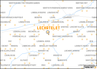
Le Châtelet (Basse-Normandie, France)Le Châtelet is a town in the Basse-Normandie region of France. An overview map of the region around Le Châtelet is displayed below.
regional and 3d topo map of Le Châtelet, France ::
Le Châtelet airports ::
The nearest airport is DOL - Deauville St Gatien, located 79.4 km north of Le Châtelet.
Other airports nearby include LME - Le Mans Arnage (87.5 km south), URO - Rouen Vallee De Seine (88.7 km north east), CFR - Caen Carpiquet (90.2 km north west), LEH - Le Havre Octeville (98.7 km north), Nearby towns ::
Auguaise (0.0km north) //
Fémisson (1.2km east) //
Le Hamel (2.2km north east) //
Bréthel (2.2km north west) //
La Josserie (2.2km south east) //
Aube-sur-Rîle (3.7km north) //
Le Ménil-Bérard (2.4km west) //
La Clémendière (3.9km north) //
Le Plessis (3.9km north) //
Écorcei (3.1km north east) //
Les Genettes (3.9km south) //
La Rabotière (3.9km south) //
Bonnefoi (3.9km south) //
Les Beslières (3.9km south) //
Le Sourdeval (4.4km north east) //
La Foulnerie (5.6km north) //
Sécheville (3.7km west) //
Breuil-en-Touraine (5.6km south) //
Le Val (5.7km north) //
Les Puisards (4.1km north east) //
La Métairie (4.1km north west) //
Saint-Martin-dʼAspres (4.1km south east) //
Notre-Dame-dʼAspres (4.1km south east) //
Le Boulay (4.1km south west) //
Bonsmoulins (5.7km south) //
Saint-Hilaire-sur-Rîle (5.2km north west) //
Beaufai (6.1km north west) //
Rai-sur-Rîle (6.1km north east) //
Launay (6.1km north west) //
[all distances 'as the bird flies' and approximate] 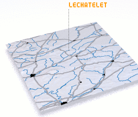 Places with similar names to Le Châtelet, France ::
// Le Châtelet (FR)
// Le Châtelet (FR)
// Le Châtelet (FR)
// Le Châtelet (FR)
// Le Châtelet (FR)
// Le Châtelet (FR)
// Lechâtelet (FR)
// Le Châtelot (FR)
Disclaimer :: Information on this page comes without warranty of any kind |
||
|
Where is Le Châtelet? Elevation and coordinates ::
Latitude (lat): 48°42'0"N Longitude (lon): 0°33'0"W
Elevation (approx.): 275m (map arrows pan, magnifying glasses zoom) |
||
|
Visiting Le Châtelet? Hotel/Accommodation ::
Book a hotel in Le Châtelet Travel Guide ::
Buy a travel guide for France rental cars ::
car rental offers GPS waypoint ::
download a GPX waypoint (PoI) of Le Châtelet for your GPS receiver
|
||