|
search place name
|
||
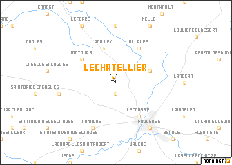
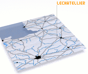
Le Châtellier (Bretagne, France)Le Châtellier is a town in the Bretagne region of France. An overview map of the region around Le Châtellier is displayed below.
regional and 3d topo map of Le Châtellier, France ::
Le Châtellier airports ::
The nearest airport is RNS - Rennes St Jacques, located 52.8 km south west of Le Châtellier.
Other airports nearby include LVA - Laval Entrammes (57.1 km south east), DNR - Dinard Pleurtuit (64.2 km west), CFR - Caen Carpiquet (102.6 km north east), JER - Jersey (112.1 km north west), Nearby towns ::
 Places with similar names to Le Châtellier, France ::
// Le Châtellier (FR)
// Le Châtelier (FR)
// Le Châtelier (FR)
// Le Châtellier (FR)
// Le Châtellier (FR)
// Le Châtellier (FR)
// Lichtelaar (BE)
Disclaimer :: Information on this page comes without warranty of any kind |
||
|
Where is Le Châtellier? Elevation and coordinates ::
Latitude (lat): 48°25'0"N Longitude (lon): 1°15'0"W
Elevation (approx.): 153m (map arrows pan, magnifying glasses zoom) |
||
|
Visiting Le Châtellier? Hotel/Accommodation ::
Book a hotel in Le Châtellier Travel Guide ::
Buy a travel guide for France rental cars ::
car rental offers GPS waypoint ::
download a GPX waypoint (PoI) of Le Châtellier for your GPS receiver
|
||