|
search place name
|
||
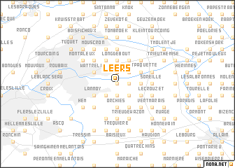
Leers (Nord-Pas-de-Calais, France)Leers is a town in the Nord-Pas-de-Calais region of France. An overview map of the region around Leers is displayed below.
regional and 3d topo map of Leers, France ::
Leers airports ::
The nearest airport is QKT - Kortrijk-vevelgem Wevelgem, located 15.2 km north of Leers.
Other airports nearby include LIL - Lille Lesquin (17.6 km south west), OST - Oostende (63.5 km north west), CRL - Charleroi Brussels South (88.9 km east), BRU - Brussels Natl (Melsbroek) (90.4 km east), Nearby towns ::
Le Rieu (0.0km north) //
Néchin (1.9km south) //
Petit Tourcoing (1.9km south) //
Gibraltar (1.9km south) //
Leers-Nord (1.2km east) //
Royère (1.2km east) //
Estaimpuis (1.9km north) //
La Horne (1.9km north) //
Salinnes (2.2km south east) //
Bucquoi (2.2km south west) //
Toufflers (2.2km south west) //
Codron (2.2km north east) //
Belva (2.3km east) //
Joncquière (2.3km east) //
Chaos (3.7km south) //
Crombrue (3.7km south) //
Orchies (3.7km south) //
Long de Bout (3.7km north) //
Lannoy (3.0km south west) //
La Wardries (3.0km south east) //
Lys-lès-Lannoy (3.0km south west) //
Pont Paquette (3.0km north east) //
Wattrelos (3.0km north west) //
Hulans (3.9km south) //
Audenarde (3.9km north) //
Quevaucamps (3.9km north) //
Sailly-lès-Lannoy (4.4km south west) //
Hauterue (4.4km south east) //
Faubourg (4.4km north east) //
[all distances 'as the bird flies' and approximate]  Places with similar names to Leers, France ::
Disclaimer :: Information on this page comes without warranty of any kind |
||
|
Where is Leers? Elevation and coordinates ::
Latitude (lat): 50°41'0"N Longitude (lon): 3°15'0"E
Elevation (approx.): 24m (map arrows pan, magnifying glasses zoom) |
||
|
Visiting Leers? Hotel/Accommodation ::
Book a hotel in Leers Travel Guide ::
Buy a travel guide for France rental cars ::
car rental offers GPS waypoint ::
download a GPX waypoint (PoI) of Leers for your GPS receiver
|
||