|
search place name
|
||
Le Havre (Basse-Normandie, France)Le Havre is a town in the Basse-Normandie region of France. An overview map of the region around Le Havre is displayed below.
regional and 3d topo map of Le Havre, France ::

Le Havre airports ::
The nearest airport is CER - Cherbourg Maupertus, located 20.1 km north west of Le Havre.
Other airports nearby include ACI - Alderney (70.5 km west), CFR - Caen Carpiquet (71.6 km south east), JER - Jersey (74.6 km south west), GCI - Guernsey (96.0 km west), Nearby towns ::
Quinéville (1.2km west) //
Saint-Marcouf (3.7km south) //
Aumeville-Lestre (3.0km north west) //
Fontenay-sur-Mer (4.4km south west) //
Lestre (3.6km west) //
Saint-Martin-dʼAudouville (4.1km north west) //
Ravenoville (5.7km south) //
Morsalines (5.7km north) //
Ozeville (4.1km south west) //
Crasville (5.2km north west) //
Azeville (6.1km south west) //
Octeville-la-Venelle (5.2km west) //
Saint-Floxel (5.2km west) //
Émondeville (6.6km south west) //
Foucarville (7.8km south) //
Joganville (7.4km south west) //
[all distances 'as the bird flies' and approximate] 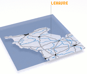 Places with similar names to Le Havre, France ::
Disclaimer :: Information on this page comes without warranty of any kind |
||
|
Where is Le Havre? Elevation and coordinates ::
Latitude (lat): 49°31'0"N Longitude (lon): 1°17'0"W
Elevation (approx.): -32768m (map arrows pan, magnifying glasses zoom) |
||
|
Visiting Le Havre? Hotel/Accommodation ::
Book a hotel in Le Havre Travel Guide ::
Buy a travel guide for France rental cars ::
car rental offers GPS waypoint ::
download a GPX waypoint (PoI) of Le Havre for your GPS receiver
|
||