|
search place name
|
||
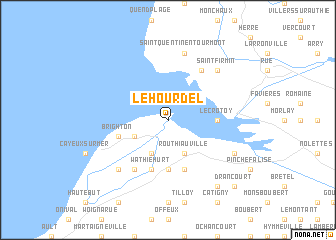
Le Hourdel (Picardie, France)Le Hourdel is a town in the Picardie region of France. An overview map of the region around Le Hourdel is displayed below.
regional and 3d topo map of Le Hourdel, France ::
Le Hourdel airports ::
The nearest airport is LTQ - Le Tourquet Le Touquet Paris Plage, located 33.7 km north of Le Hourdel.
Other airports nearby include CQF - Calais Dunkerque (87.4 km north), BVA - Beauvais Tille (93.4 km south east), LYX - Lydd (93.5 km north west), URO - Rouen Vallee De Seine (96.8 km south), Nearby towns ::
Routhiauville (3.9km south) //
Mollière dʼAmont (3.9km south) //
Mollière dʼAval (3.0km south west) //
Sallenelle (5.6km south) //
Le Crotoy (3.6km east) //
Pendé (5.7km south) //
Lanchères (5.7km south) //
Wathiéhurt (5.7km south) //
Brighton (4.0km south west) //
Le Bout des Crocs (6.0km north east) //
Hurt (6.0km south west) //
Saint-Quentin-en-Tourmont (7.5km north) //
Le Marais (6.6km south west) //
Saint-Firmin (6.6km north east) //
Saint-Valéry-sur-Somme (6.0km south east) //
Estréboeuf (8.2km south east) //
Drancourt (8.8km south east) //
[all distances 'as the bird flies' and approximate] 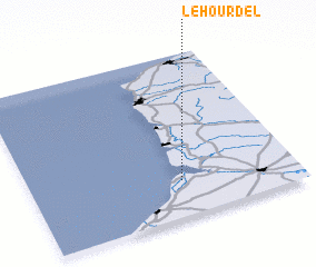 Places with similar names to Le Hourdel, France :: Disclaimer :: Information on this page comes without warranty of any kind |
||
|
Where is Le Hourdel? Elevation and coordinates ::
Latitude (lat): 50°13'0"N Longitude (lon): 1°34'0"E
Elevation (approx.): 3m (map arrows pan, magnifying glasses zoom) |
||
|
Visiting Le Hourdel? Hotel/Accommodation ::
Book a hotel in Le Hourdel Travel Guide ::
Buy a travel guide for France rental cars ::
car rental offers GPS waypoint ::
download a GPX waypoint (PoI) of Le Hourdel for your GPS receiver
|
||