|
search place name
|
||
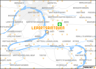
Le Port-Saint-Ouen (Haute-Normandie, France)Le Port-Saint-Ouen is a town in the Haute-Normandie region of France. An overview map of the region around Le Port-Saint-Ouen is displayed below.
regional and 3d topo map of Le Port-Saint-Ouen, France ::
Le Port-Saint-Ouen airports ::
The nearest airport is URO - Rouen Vallee De Seine, located 4.8 km north east of Le Port-Saint-Ouen.
Other airports nearby include DOL - Deauville St Gatien (71.1 km west), POX - Pontoise Cormeilles En Vexin (71.9 km south east), BVA - Beauvais Tille (72.0 km east), LEH - Le Havre Octeville (78.5 km west), Nearby towns ::
Gouy (1.2km east) //
Les Authieux-sur-le-Port-Saint-Ouen (1.9km south) //
Incarville (2.2km north east) //
Sotteville-sous-le-Val (3.7km south) //
Celloville (3.9km north) //
Tourville-la-Rivière (3.0km south west) //
Oissel (3.0km south west) //
Igoville (3.9km south) //
Les Veys (3.9km south) //
Saint-Aubin-Celloville (3.0km north east) //
Saint-Étienne-du-Rouvray (4.4km north west) //
Ymare (3.6km east) //
Amfreville-la-Mi-Voie (5.7km north) //
Belbeuf (5.7km north) //
Alizay (5.2km south east) //
Freneuse (5.2km south west) //
Criquebeuf-sur-Seine (6.1km south west) //
Notre-Dame-de-Franqueville (6.1km north east) //
Pont-de-lʼArche (6.1km south east) //
Quévreville-la-Poterie (4.8km east) //
Eauplet (7.5km north) //
Le Mesnil-Esnard (7.5km north) //
Saint-Pierre-de-Franqueville (6.6km north east) //
Les Damps (6.6km south east) //
Bédanne (6.1km south west) //
Boos (6.1km north east) //
Sotteville-lès-Rouen (7.8km north) //
Le Manoir (6.1km south east) //
Saint-Aubin-Epinay (7.8km north) //
[all distances 'as the bird flies' and approximate] 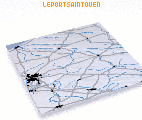 Places with similar names to Le Port-Saint-Ouen, France :: Disclaimer :: Information on this page comes without warranty of any kind |
||
|
Where is Le Port-Saint-Ouen? Elevation and coordinates ::
Latitude (lat): 49°21'0"N Longitude (lon): 1°8'0"E
Elevation (approx.): 66m (map arrows pan, magnifying glasses zoom) |
||
|
Visiting Le Port-Saint-Ouen? Hotel/Accommodation ::
Book a hotel in Le Port-Saint-Ouen Travel Guide ::
Buy a travel guide for France rental cars ::
car rental offers GPS waypoint ::
download a GPX waypoint (PoI) of Le Port-Saint-Ouen for your GPS receiver
|
||