|
search place name
|
||
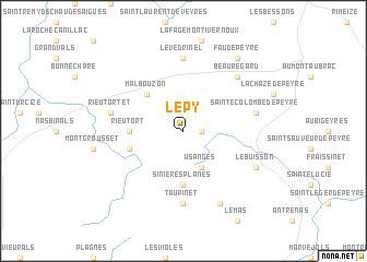
Le Py (Languedoc-Roussillon, France)Le Py is a town in the Languedoc-Roussillon region of France. An overview map of the region around Le Py is displayed below.
regional and 3d topo map of Le Py, France ::
Le Py airports ::
The nearest airport is MEN - Mende Brenoux, located 34.3 km south east of Le Py.
Other airports nearby include RDZ - Rodez Marcillac (61.5 km south west), AUR - Aurillac (64.0 km north west), LPY - Le Puy Loudes (65.9 km north east), OBS - Aubenas-vals-lanas Ardeche Meridionale (96.7 km east), Nearby towns ::
Prinsuéjols (1.3km east) //
Usanges (3.9km south) //
Malbouzon (4.5km north west) //
Sinières-Planes (5.6km south) //
Rieutort (4.0km west) //
Marchastel (4.4km south west) //
Le Védrinel (7.4km north) //
Taupinet (7.4km south) //
Sainte-Colombe-de-Peyre (5.6km east) //
Rieutortet (5.6km west) //
Beauregard (6.8km north east) //
Le Buisson (6.4km south east) //
Saint-Laurent-de-Muret (7.9km south) //
Fau-de-Peyre (8.4km north east) //
[all distances 'as the bird flies' and approximate] 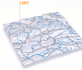 Places with similar names to Le Py, France ::
Disclaimer :: Information on this page comes without warranty of any kind |
||
|
Where is Le Py? Elevation and coordinates ::
Latitude (lat): 44°40'0"N Longitude (lon): 3°10'0"E
Elevation (approx.): 1252m (map arrows pan, magnifying glasses zoom) |
||
|
Visiting Le Py? Hotel/Accommodation ::
Book a hotel in Le Py Travel Guide ::
Buy a travel guide for France rental cars ::
car rental offers GPS waypoint ::
download a GPX waypoint (PoI) of Le Py for your GPS receiver
|
||