|
search place name
|
||
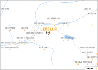
LʼÉrella (Rhône-Alpes, France)LʼÉrella is a town in the Rhône-Alpes region of France. An overview map of the region around LʼÉrella is displayed below.
regional and 3d topo map of LʼÉrella, France ::
LʼÉrella airports ::
The nearest airport is TRN - Torino, located 63.0 km east of LʼÉrella.
Other airports nearby include CMF - Chambery Aix Les Bains (87.3 km north west), NCY - Annecy Meythet (95.6 km north west), CUF - Levaldigi (99.2 km south east), SIR - Sion (114.0 km north), Nearby towns ::
Lanslebourg-Mont-Cenis (3.9km north) //
Termignon (4.5km north west) //
Sollières-Envers (3.9km west) //
Le Châtelard (5.7km north) //
Le Planey (5.7km south) //
Sollières-Sardières (4.3km north west) //
Le Châtel (4.3km south west) //
Le Rivet (4.3km south east) //
Les Champs (5.4km north east) //
Sardières (5.5km west) //
Le Verney (5.5km west) //
Rivers-Derrière (5.5km east) //
Lanslevillard (6.4km north east) //
LʼAdroit (6.4km north east) //
[all distances 'as the bird flies' and approximate] 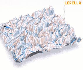 Places with similar names to LʼÉrella, France ::
Disclaimer :: Information on this page comes without warranty of any kind |
||
|
Where is LʼÉrella? Elevation and coordinates ::
Latitude (lat): 45°15'0"N Longitude (lon): 6°51'0"E
Elevation (approx.): 2391m (map arrows pan, magnifying glasses zoom) |
||
|
Visiting LʼÉrella? Hotel/Accommodation ::
Book a hotel in LʼÉrella Travel Guide ::
Buy a travel guide for France rental cars ::
car rental offers GPS waypoint ::
download a GPX waypoint (PoI) of LʼÉrella for your GPS receiver
|
||