|
search place name
|
||
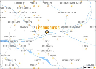
Les Barbiers (Bourgogne, France)Les Barbiers is a town in the Bourgogne region of France. An overview map of the region around Les Barbiers is displayed below.
regional and 3d topo map of Les Barbiers, France ::
Les Barbiers airports ::
The nearest airport is NVS - Nevers Fourchambault, located 38.9 km north west of Les Barbiers.
Other airports nearby include XMU - Moulins Montbeugny (38.9 km south), VHY - Vichy Charmeil (78.7 km south), XCD - Chalon Champforgeuil (94.3 km east), BOU - Bourges (94.7 km west), Nearby towns ::
LʼUsage (1.3km west) //
Saint-Gervais (2.2km south west) //
Verneuil (2.5km west) //
Faye (3.7km south) //
Villevelle (3.1km north west) //
Les Arreauts (3.1km south east) //
Aubigny-le-Chétif (4.5km north west) //
Avril-les-Loups (4.5km north west) //
Diennes-Aubigny (5.6km north) //
Vanzé (3.8km west) //
Les Boulas (5.6km south) //
Romenay (6.1km north west) //
Cercy-la-Tour (5.1km east) //
Les Arbelats (7.4km south) //
Nolats (6.3km north west) //
La Garenne (7.8km north) //
Champvert (6.3km south west) //
Fougère (6.3km south west) //
Devay (7.8km south) //
Poisson (7.5km north west) //
Langy (8.3km north west) //
Montigny-sur-Canne (9.0km north east) //
[all distances 'as the bird flies' and approximate] 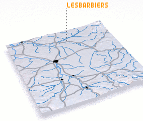 Places with similar names to Les Barbiers, France :: Disclaimer :: Information on this page comes without warranty of any kind |
||
|
Where is Les Barbiers? Elevation and coordinates ::
Latitude (lat): 46°52'0"N Longitude (lon): 3°35'0"E
Elevation (approx.): 205m (map arrows pan, magnifying glasses zoom) |
||
|
Visiting Les Barbiers? Hotel/Accommodation ::
Book a hotel in Les Barbiers Travel Guide ::
Buy a travel guide for France rental cars ::
car rental offers GPS waypoint ::
download a GPX waypoint (PoI) of Les Barbiers for your GPS receiver
|
||