|
search place name
|
||
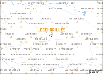
Les Chopilles (Centre, France)Les Chopilles is a town in the Centre region of France. An overview map of the region around Les Chopilles is displayed below.
regional and 3d topo map of Les Chopilles, France ::
Les Chopilles airports ::
The nearest airport is AUF - Auxerre Branches, located 46.8 km south east of Les Chopilles.
Other airports nearby include QYR - Troyes Barberey (86.7 km east), ORE - Orleans Bricy (87.6 km west), ORY - Paris Orly (87.9 km north west), TNF - Toussous-le-noble Toussus Le Noble (100.7 km north west), Nearby towns ::
Les Gobets (1.2km west) //
Courtemaux (1.9km north) //
Saint-Loup-de-Gonois (2.2km north west) //
Les Noiraults (2.2km south east) //
Les Courillons (2.2km south east) //
Les Passerats (2.5km west) //
Thorailles (3.1km south west) //
La Selle-en-Hermoy (3.1km south west) //
Chantecoq (3.1km north east) //
Les Chaloches (4.5km south west) //
Chuelles (4.5km south east) //
Les Courillons (4.5km north east) //
Mérinville (5.6km north) //
Les Gautrois (3.7km east) //
Louzouer (3.7km west) //
Les Buzets (5.6km south) //
Les Dulys (5.6km south) //
Les Râles (5.7km north) //
Les Chèvereaux (5.2km north east) //
La Grande Maison (5.2km north west) //
La Selle-sur-le-Bied (5.2km north west) //
Les Richoux (5.0km west) //
Les Fétus (5.0km east) //
Les Gauguins (5.0km east) //
Saint-Firmin-des-Bois (7.5km south) //
Les Grands Bois (7.5km south) //
Ervauville (6.7km north east) //
Les Glandons (6.7km south east) //
La Martinière (6.2km south west) //
[all distances 'as the bird flies' and approximate] 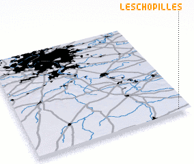 Places with similar names to Les Chopilles, France ::
// Los Copales (MX)
// Los Copales (HN)
// Los Capules (NI)
// Les Chapelles (FR)
// Les Chapelles (FR)
// Las Capillas (AR)
// Las Capelles (FR)
// Les Chapelles (FR)
// Les Chapelles (FR)
// Les Chapelles (FR)
Disclaimer :: Information on this page comes without warranty of any kind |
||
|
Where is Les Chopilles? Elevation and coordinates ::
Latitude (lat): 48°2'0"N Longitude (lon): 2°56'0"E
Elevation (approx.): 136m (map arrows pan, magnifying glasses zoom) |
||
|
Visiting Les Chopilles? Hotel/Accommodation ::
Book a hotel in Les Chopilles Travel Guide ::
Buy a travel guide for France rental cars ::
car rental offers GPS waypoint ::
download a GPX waypoint (PoI) of Les Chopilles for your GPS receiver
|
||