|
search place name
|
||
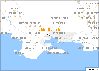
Les Routes (Provence-Alpes-Côte dʼAzur, France)Les Routes is a town in the Provence-Alpes-Côte dʼAzur region of France. An overview map of the region around Les Routes is displayed below.
regional and 3d topo map of Les Routes, France ::
Les Routes airports ::
The nearest airport is CTT - Le Castellet, located 16.2 km north west of Les Routes.
Other airports nearby include TLN - Hyeres Le Palyvestre (20.4 km east), QXB - Aix-les-milles Aix Les Milles (59.8 km north west), MRS - Marseille Provence (65.0 km north west), CEQ - Cannes Mandelieu (96.7 km north east), Nearby towns ::
Valbourdin (1.4km east) //
Les Quatre Chemins (1.9km north) //
Lagoubran (2.3km south west) //
Sainte-Anne (2.7km east) //
Toulon (3.3km south east) //
La Seyne-sur-Mer (3.9km south) //
Le Mourillon (4.6km south east) //
Dardennes (4.6km north east) //
Le Broussan (4.6km north west) //
Saint-Elme (5.6km south) //
Tamaris-sur-Mer (5.6km south) //
Ollioules (4.1km west) //
Aguillon (4.5km south east) //
Saint-Jean du Var (4.5km south east) //
Les Sablettes (5.7km south) //
Six-Fours-la-Plage (5.5km south west) //
Le Revest-le-Eaux (6.2km north east) //
Évenos (5.5km north west) //
Les Darboussèdes (5.4km east) //
Beaulieu (5.4km east) //
Brunet (5.4km east) //
La Palasse (5.7km east) //
Les Playes (5.7km west) //
Saint-Mandrier-sur-Mer (7.9km south) //
Sainte-Anne-dʼÉvenos (6.6km north west) //
Curet (7.8km south west) //
Jouglas (7.8km south west) //
[all distances 'as the bird flies' and approximate] 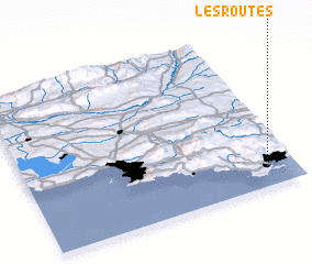 Places with similar names to Les Routes, France ::
// Los Cerritos (US)
// Los Cerritos (PA)
// Los Cerritos (PA)
// Los Cerritos (PA)
// Los Cerritos (PA)
// Los Cerritos (PA)
// Los Cerritos (PA)
// Los Cerritos (PA)
// Los Cerritos (PA)
// Los Cerritos (PA)
Disclaimer :: Information on this page comes without warranty of any kind |
||
|
Where is Les Routes? Elevation and coordinates ::
Latitude (lat): 43°8'0"N Longitude (lon): 5°54'0"E
Elevation (approx.): 33m (map arrows pan, magnifying glasses zoom) |
||
|
Visiting Les Routes? Hotel/Accommodation ::
Book a hotel in Les Routes Travel Guide ::
Buy a travel guide for France rental cars ::
car rental offers GPS waypoint ::
download a GPX waypoint (PoI) of Les Routes for your GPS receiver
|
||