|
search place name
|
||
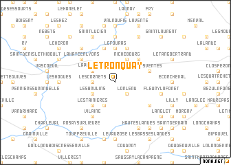
Le Tronquay (Haute-Normandie, France)Le Tronquay is a town in the Haute-Normandie region of France. An overview map of the region around Le Tronquay is displayed below.
regional and 3d topo map of Le Tronquay, France ::
Le Tronquay airports ::
The nearest airport is URO - Rouen Vallee De Seine, located 23.0 km west of Le Tronquay.
Other airports nearby include BVA - Beauvais Tille (45.7 km east), POX - Pontoise Cormeilles En Vexin (55.2 km south east), CSF - Creil (77.9 km east), LBG - Paris Le Bourget (86.8 km south east), Nearby towns ::
Lorleau (2.2km south east) //
Les Cornets (2.4km west) //
Les Brulins (3.0km south west) //
Lyons-la-Forêt (3.9km south) //
La Garenne (3.0km north west) //
Fresnay (3.0km north west) //
La Pocquerie (3.0km north west) //
Entre-Deux-Landes (3.9km north) //
Richebourg (3.9km north) //
Les Tainières (4.4km south west) //
La Feuillie (4.4km north east) //
Le Camp Jean (4.4km north east) //
Le Fouras (5.6km north) //
Boulay (5.7km north) //
Yvetot-Bocage (5.7km north) //
Les Ventes (4.1km north east) //
Beauficel-en-Lyons (5.2km south east) //
Le Roule (6.1km south west) //
Vilaine (6.1km south west) //
La Haye-en-Lyons (5.2km north west) //
Montagny (7.4km north) //
Nolléval (7.4km north) //
Fleury-la-Forêt (5.2km east) //
Morville-sur-Andelle (6.6km north west) //
Hautes Landes (7.8km south) //
Le Quesne (7.8km north) //
Saint-Lucien (7.8km north) //
Le Mesnil-Lieubray (7.8km north) //
Goupillère (8.2km south east) //
[all distances 'as the bird flies' and approximate] 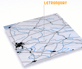 Places with similar names to Le Tronquay, France ::
Disclaimer :: Information on this page comes without warranty of any kind |
||
|
Where is Le Tronquay? Elevation and coordinates ::
Latitude (lat): 49°26'0"N Longitude (lon): 1°29'0"E
Elevation (approx.): 156m (map arrows pan, magnifying glasses zoom) |
||
|
Visiting Le Tronquay? Hotel/Accommodation ::
Book a hotel in Le Tronquay Travel Guide ::
Buy a travel guide for France rental cars ::
car rental offers GPS waypoint ::
download a GPX waypoint (PoI) of Le Tronquay for your GPS receiver
|
||