|
search place name
|
||
Loon-Plage (Nord-Pas-de-Calais, France)Loon-Plage is a town in the Nord-Pas-de-Calais region of France. An overview map of the region around Loon-Plage is displayed below.
regional and 3d topo map of Loon-Plage, France ::

Loon-Plage airports ::
The nearest airport is CQF - Calais Dunkerque, located 18.5 km west of Loon-Plage.
Other airports nearby include OST - Oostende (51.2 km north east), LTQ - Le Tourquet Le Touquet Paris Plage (66.8 km south west), QKT - Kortrijk-vevelgem Wevelgem (71.9 km east), MSE - Manston (72.8 km north west), Nearby towns ::
Les Planches (1.9km south) //
Craywick (2.2km south east) //
Bourbourg- Campagne (3.9km south) //
Bourbourg (3.9km south) //
Mardyck (4.4km north east) //
Le Clipon (5.6km north) //
Saint-Georges-sur-lʼAa (4.0km south west) //
Hameau des Dunes (5.7km north) //
Coppenaxfort (5.1km south east) //
Les Huttes (5.0km west) //
Grande-Synthe (5.7km north east) //
Brouckerque (6.0km south east) //
Looberghe (8.2km south east) //
Saint-Nicolas (8.2km south west) //
Le Guindal (7.3km south west) //
[all distances 'as the bird flies' and approximate] 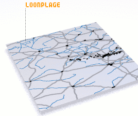 Places with similar names to Loon-Plage, France :: Disclaimer :: Information on this page comes without warranty of any kind |
||
|
Where is Loon-Plage? Elevation and coordinates ::
Latitude (lat): 50°59'0"N Longitude (lon): 2°13'0"E
Elevation (approx.): 1m (map arrows pan, magnifying glasses zoom) |
||
|
Visiting Loon-Plage? Hotel/Accommodation ::
Book a hotel in Loon-Plage Travel Guide ::
Buy a travel guide for France rental cars ::
car rental offers GPS waypoint ::
download a GPX waypoint (PoI) of Loon-Plage for your GPS receiver
|
||