|
search place name
|
||
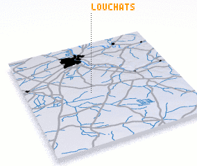
Louchats (Aquitaine, France)Louchats is a town in the Aquitaine region of France. An overview map of the region around Louchats is displayed below.
regional and 3d topo map of Louchats, France ::

Louchats airports ::
The nearest airport is BOD - Bordeaux Merignac, located 36.2 km north of Louchats.
Other airports nearby include XAC - Arcachon La Teste De Buch (42.8 km west), EGC - Bergerac Roumaniere (93.9 km east), AGF - Agen La Garenne (101.0 km east), PUF - Pau Pyrenees (127.0 km south), Nearby towns ::
 Places with similar names to Louchats, France ::
// Los Haitíes (CU)
// Luchitsa (UA)
// Luchitsy (UA)
// Loshitsy (RU)
// Louis Heights (US)
// Los Hatos (HN)
// Los Hatos (VE)
// Los Hatos (VE)
// Los Hatos (VE)
// Les Hattes (GF)
Disclaimer :: Information on this page comes without warranty of any kind |
||
|
Where is Louchats? Elevation and coordinates ::
Latitude (lat): 44°31'0"N Longitude (lon): 0°35'0"W
Elevation (approx.): 73m (map arrows pan, magnifying glasses zoom) |
||
|
Visiting Louchats? Hotel/Accommodation ::
Book a hotel in Louchats Travel Guide ::
Buy a travel guide for France rental cars ::
car rental offers GPS waypoint ::
download a GPX waypoint (PoI) of Louchats for your GPS receiver
|
||