|
search place name
|
||
Lozé (Auvergne, France)Lozé is a town in the Auvergne region of France. An overview map of the region around Lozé is displayed below.
regional and 3d topo map of Lozé, France ::

Lozé airports ::
The nearest airport is MCU - Montlucon Domerat, located 15.5 km south of Lozé.
Other airports nearby include MCU - Montlucon-gueret Montlucon Gueret (30.8 km south), BOU - Bourges (64.7 km north), XMU - Moulins Montbeugny (71.1 km east), CHR - Chateauroux Deols (72.4 km north west), Nearby towns ::
Champémon (1.3km east) //
Le Soult (1.3km west) //
Coutine (3.7km south) //
Chauvière (2.6km west) //
Chazemais (2.6km east) //
Penserole (3.7km north) //
Les Prugnes (4.5km south west) //
Faye (4.5km north west) //
Mondan (4.5km north west) //
Les Bergettes (5.6km south) //
Les Maisons (4.3km south east) //
La Villette (5.3km south west) //
Caux (6.1km south east) //
La Vallas (6.1km south west) //
Saint-Vitte (6.1km north east) //
Villevendret (5.3km north east) //
La Chapelaude (7.4km south) //
Vernet (7.4km north) //
Saint-Sornin (7.5km south) //
Montroir (7.5km south) //
Courçais (5.4km west) //
Saint-Désiré (5.4km west) //
Palières (6.8km south west) //
Forgette (6.3km south west) //
Audes (6.3km south east) //
La Boutellière (6.3km south west) //
Vallant (7.8km north) //
Pardeux (8.3km south west) //
Les Chiez (8.3km south west) //
[all distances 'as the bird flies' and approximate] 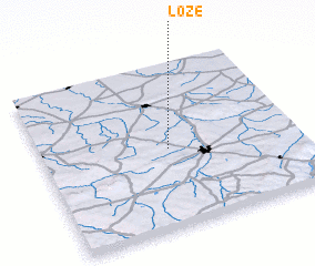 Places with similar names to Lozé, France ::
Disclaimer :: Information on this page comes without warranty of any kind |
||
|
Where is Lozé? Elevation and coordinates ::
Latitude (lat): 46°29'0"N Longitude (lon): 2°30'0"E
Elevation (approx.): 286m (map arrows pan, magnifying glasses zoom) |
||
|
Visiting Lozé? Hotel/Accommodation ::
Book a hotel in Lozé Travel Guide ::
Buy a travel guide for France rental cars ::
car rental offers GPS waypoint ::
download a GPX waypoint (PoI) of Lozé for your GPS receiver
|
||