|
search place name
|
||
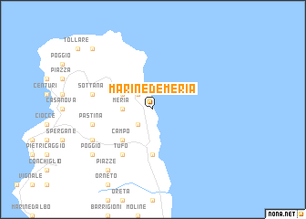
Marine de Meria (France)Marine de Meria is a town in France. An overview map of the region around Marine de Meria is displayed below.
regional and 3d topo map of Marine de Meria, France ::
Marine de Meria airports ::
The nearest airport is BIA - Bastia Poretta, located 42.3 km south of Marine de Meria.
Other airports nearby include EBA - Marina Di Campo (66.0 km east), CLY - Calvi Saint Catherine (71.0 km south west), SOZ - Solenzara (112.2 km south), PSA - Pisa (112.2 km north east), Nearby towns ::
Caraco (2.3km south west) //
Macinaggio (2.3km north west) //
Meria (2.7km west) //
Mandolacce (3.3km north west) //
Campo (4.6km south west) //
Santa-Severa (5.6km south) //
Portocciolo (5.6km south) //
Marine de Luri (5.6km south) //
Tufo (6.2km south west) //
Pastina (5.7km west) //
Quarcioli (5.7km west) //
Sottana (5.7km west) //
Soprana (5.7km west) //
Orenola (6.6km south west) //
Piazze (8.5km south west) //
Ghilloni (8.5km south west) //
La Pedina (8.5km south west) //
Carbonacce (7.8km south west) //
Piazza (7.8km south west) //
Poggio (7.8km south west) //
Barcaggio (9.2km north west) //
[all distances 'as the bird flies' and approximate]  Places with similar names to Marine de Meria, France :: Disclaimer :: Information on this page comes without warranty of any kind |
||
|
Where is Marine de Meria? Elevation and coordinates ::
Latitude (lat): 42°56'0"N Longitude (lon): 9°28'0"E
Elevation (approx.): -32768m (map arrows pan, magnifying glasses zoom) |
||
|
Visiting Marine de Meria? Hotel/Accommodation ::
Book a hotel in Marine de Meria Travel Guide ::
Buy a travel guide for France rental cars ::
car rental offers GPS waypoint ::
download a GPX waypoint (PoI) of Marine de Meria for your GPS receiver
|
||