|
search place name
|
||
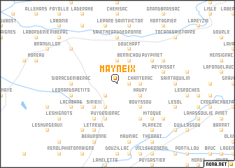
Mayneix (Aquitaine, France)Mayneix is a town in the Aquitaine region of France. An overview map of the region around Mayneix is displayed below.
regional and 3d topo map of Mayneix, France ::
Mayneix airports ::
The nearest airport is PGX - Perigueux Bassillac, located 31.4 km east of Mayneix.
Other airports nearby include EGC - Bergerac Roumaniere (40.6 km south), ANG - Angouleme Brie Champniers (62.6 km north), CNG - Cognac Chateaubernard (78.0 km north west), BVE - Brive La Roche (82.8 km east), Nearby towns ::
LʼHôpital (1.3km east) //
La Gilardie (1.9km north) //
Roumagnac (1.9km north) //
Saint-Vincent-de-Connezac (2.3km south west) //
Ségonzac (2.3km north east) //
Saint-Sulpice-de-Roumagnac (2.3km north west) //
Chantérac (2.6km east) //
Saint-Pardoux-de-Dronne (3.7km north) //
Maury (3.2km south east) //
Beautery (3.2km south east) //
Saint-Jean-de-Ataux (3.9km south) //
Bernichou (3.9km north) //
Bouyssou (4.5km south east) //
Sirieix (4.5km south west) //
Douchapt (5.7km north) //
Puy de Siorac (5.7km south) //
Lamaud (5.4km south west) //
Saint-Germain-du-Salembre (6.1km south east) //
Puypinet (5.4km north east) //
Laveyssière (6.1km south west) //
Saint-Méard-de-Dronne (7.4km north) //
Siorac-de-Ribérac (5.2km west) //
Peypissot (5.5km east) //
Léonards Petits (5.5km west) //
Mitoque (6.8km south east) //
Le Treuil (7.9km south) //
La Martinie (6.4km north east) //
La Cabane (6.4km south west) //
Coutancias (8.4km south west) //
[all distances 'as the bird flies' and approximate] 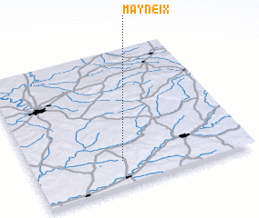 Places with similar names to Mayneix, France ::
Disclaimer :: Information on this page comes without warranty of any kind |
||
|
Where is Mayneix? Elevation and coordinates ::
Latitude (lat): 45°11'0"N Longitude (lon): 0°25'0"W
Elevation (approx.): 185m (map arrows pan, magnifying glasses zoom) |
||
|
Visiting Mayneix? Hotel/Accommodation ::
Book a hotel in Mayneix Travel Guide ::
Buy a travel guide for France rental cars ::
car rental offers GPS waypoint ::
download a GPX waypoint (PoI) of Mayneix for your GPS receiver
|
||