|
search place name
|
||
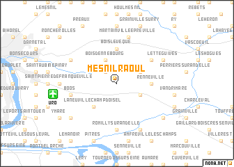
Mesnil-Raoul (Haute-Normandie, France)Mesnil-Raoul is a town in the Haute-Normandie region of France. An overview map of the region around Mesnil-Raoul is displayed below.
regional and 3d topo map of Mesnil-Raoul, France ::
Mesnil-Raoul airports ::
The nearest airport is URO - Rouen Vallee De Seine, located 6.9 km west of Mesnil-Raoul.
Other airports nearby include BVA - Beauvais Tille (61.7 km east), POX - Pontoise Cormeilles En Vexin (65.7 km south east), DOL - Deauville St Gatien (80.9 km west), LEH - Le Havre Octeville (86.7 km west), Nearby towns ::
Montmain (2.2km north west) //
Bourg-Beaudouin (3.0km south east) //
Fresne-le-Plan (3.0km north east) //
Bois-dʼEnnebourg (3.9km north) //
La Neuville-Champ-dʼOisel (4.4km south west) //
Renneville (3.6km east) //
Bois-lʼÉvêque (5.6km north) //
Auzouville-sur-Ry (5.2km north east) //
Pont-Saint-Pierre (7.4km south) //
Romilly-sur-Andelle (7.4km south) //
Martainville-Épreville (7.5km north) //
Boos (5.2km west) //
Letteguives (6.1km north east) //
Douville-sur-Andelle (7.8km south) //
Saint-Jacques-sur-Darnétal (6.1km north west) //
Radepont (7.4km south east) //
Quévreville-la-Poterie (7.4km south west) //
[all distances 'as the bird flies' and approximate] 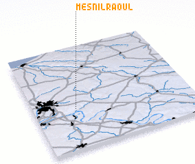 Places with similar names to Mesnil-Raoul, France :: Disclaimer :: Information on this page comes without warranty of any kind |
||
|
Where is Mesnil-Raoul? Elevation and coordinates ::
Latitude (lat): 49°24'0"N Longitude (lon): 1°16'0"E
Elevation (approx.): 155m (map arrows pan, magnifying glasses zoom) |
||
|
Visiting Mesnil-Raoul? Hotel/Accommodation ::
Book a hotel in Mesnil-Raoul Travel Guide ::
Buy a travel guide for France rental cars ::
car rental offers GPS waypoint ::
download a GPX waypoint (PoI) of Mesnil-Raoul for your GPS receiver
|
||