|
search place name
|
||
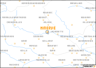
Minerve (Languedoc-Roussillon, France)Minerve is a town in the Languedoc-Roussillon region of France. An overview map of the region around Minerve is displayed below.
regional and 3d topo map of Minerve, France ::
Minerve airports ::
The nearest airport is CCF - Carcassonne Salvaza, located 39.0 km west of Minerve.
Other airports nearby include DCM - Castres Mazamet (43.8 km north west), BZR - Beziers Vias (49.1 km east), PGF - Perpignan Rivesaltes (68.4 km south), LBI - Albi Le Sequestre (81.0 km north west), Nearby towns ::
Vélieux (3.7km north) //
La Caunette (2.7km east) //
Azillanet (3.7km south) //
Cesseras (3.3km south west) //
Boisset (5.7km north) //
Beaufort (5.7km south) //
Rieussec (7.4km north) //
Oupia (7.5km south) //
Aigues-Vives (5.7km east) //
Aigne (5.7km east) //
Pépieux (6.9km south west) //
[all distances 'as the bird flies' and approximate] 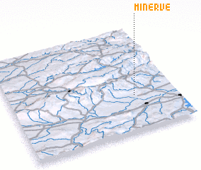 Places with similar names to Minerve, France ::
Disclaimer :: Information on this page comes without warranty of any kind |
||
|
Where is Minerve? Elevation and coordinates ::
Latitude (lat): 43°21'0"N Longitude (lon): 2°45'0"E
Elevation (approx.): 149m (map arrows pan, magnifying glasses zoom) |
||
|
Visiting Minerve? Hotel/Accommodation ::
Book a hotel in Minerve Travel Guide ::
Buy a travel guide for France rental cars ::
car rental offers GPS waypoint ::
download a GPX waypoint (PoI) of Minerve for your GPS receiver
|
||