|
search place name
|
||
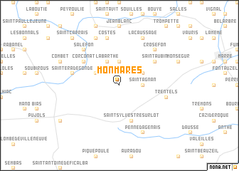
Monmares (Aquitaine, France)Monmares is a town in the Aquitaine region of France. An overview map of the region around Monmares is displayed below.
regional and 3d topo map of Monmares, France ::
Monmares airports ::
The nearest airport is AGF - Agen La Garenne, located 34.9 km south west of Monmares.
Other airports nearby include EGC - Bergerac Roumaniere (47.3 km north west), PGX - Perigueux Bassillac (83.1 km north), BVE - Brive La Roche (94.2 km north east), TLS - Toulouse Blagnac (101.8 km south east), Nearby towns ::
Savignac-sur-Leyze (3.7km north) //
Saint-Agnan (2.6km east) //
Labarthe (3.9km north) //
LʼEspère (3.2km north east) //
Bussac (3.2km north west) //
Saint-Sylvestre-sur-Lot (5.7km south) //
Saint-Aubin (5.4km north east) //
Corconat (5.4km north west) //
La Sauvetat-sur-Lède (5.6km west) //
Sainte-Radegonde (5.6km west) //
Costes (7.5km north) //
Trentels (5.6km east) //
Crosefon (6.8km north east) //
Salefon (6.8km north west) //
Lacaussade (7.9km north) //
Calviac (7.9km north) //
Penne-dʼAgenais (7.9km south) //
Saint-Caprais (9.1km north west) //
[all distances 'as the bird flies' and approximate] 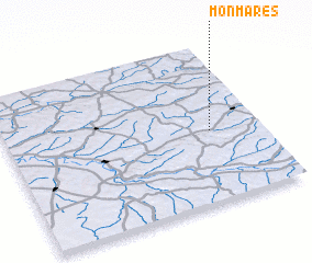
Disclaimer :: Information on this page comes without warranty of any kind |
||
|
Where is Monmares? Elevation and coordinates ::
Latitude (lat): 44°27'0"N Longitude (lon): 0°48'0"W
Elevation (approx.): 123m (map arrows pan, magnifying glasses zoom) |
||
|
Visiting Monmares? Hotel/Accommodation ::
Book a hotel in Monmares Travel Guide ::
Buy a travel guide for France rental cars ::
car rental offers GPS waypoint ::
download a GPX waypoint (PoI) of Monmares for your GPS receiver
|
||