|
search place name
|
||
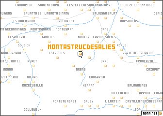
Montastruc-de-Salies (Midi-Pyrénées, France)Montastruc-de-Salies is a town in the Midi-Pyrénées region of France. An overview map of the region around Montastruc-de-Salies is displayed below.
regional and 3d topo map of Montastruc-de-Salies, France ::
Montastruc-de-Salies airports ::
The nearest airport is LRH - La Rochelle Lherm, located 54.8 km north east of Montastruc-de-Salies.
Other airports nearby include LDE - Tarbes Lourdes (75.5 km west), TLS - Toulouse Blagnac (76.1 km north east), LEU - Seo De Urgel (87.7 km south east), PUF - Pau Pyrenees (113.9 km west), Nearby towns ::
Rouède (1.9km north) //
Castelbiague (1.4km east) //
Chein-Dessus (2.3km south west) //
Arbas (3.7km south) //
Montgaillard-de-Salies (4.6km north east) //
Figarol (5.6km north) //
Estadens (4.1km west) //
Urau (4.5km south east) //
Montespan (6.2km north west) //
Fougaron (6.2km south east) //
Herran (7.5km south) //
Saleich (5.7km east) //
Castagnède (5.7km east) //
Mane (6.9km north east) //
Beauchalot (7.9km north) //
His (6.6km north east) //
Ganties (6.6km north west) //
Touille (7.8km north east) //
[all distances 'as the bird flies' and approximate] 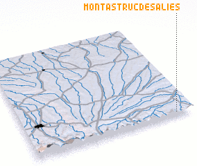 Places with similar names to Montastruc-de-Salies, France :: Disclaimer :: Information on this page comes without warranty of any kind |
||
|
Where is Montastruc-de-Salies? Elevation and coordinates ::
Latitude (lat): 43°2'0"N Longitude (lon): 0°54'0"W
Elevation (approx.): 396m (map arrows pan, magnifying glasses zoom) |
||
|
Visiting Montastruc-de-Salies? Hotel/Accommodation ::
Book a hotel in Montastruc-de-Salies Travel Guide ::
Buy a travel guide for France rental cars ::
car rental offers GPS waypoint ::
download a GPX waypoint (PoI) of Montastruc-de-Salies for your GPS receiver
|
||