|
search place name
|
||
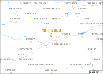
Montbolo (Languedoc-Roussillon, France)Montbolo is a town in the Languedoc-Roussillon region of France. An overview map of the region around Montbolo is displayed below.
regional and 3d topo map of Montbolo, France ::
Montbolo airports ::
The nearest airport is PGF - Perpignan Rivesaltes, located 33.8 km north east of Montbolo.
Other airports nearby include GRO - Gerona Girona (65.3 km south), CCF - Carcassonne Salvaza (86.1 km north), LEU - Seo De Urgel (103.4 km west), BZR - Beziers Vias (109.6 km north east), Nearby towns ::
Palalda (1.4km east) //
Amélie-les-Bains-Palalda (2.3km south east) //
Arles-sur-Tech (4.0km south) //
Taulis (4.0km north) //
Montalba-dʼAmélie (4.6km south east) //
Reynès (4.1km east) //
Taillet (5.7km north) //
Saint-Marsal (6.2km north west) //
Corsavy (5.8km west) //
Calmeilles (7.9km north) //
Oms (8.5km north east) //
La Bastide (9.2km north west) //
[all distances 'as the bird flies' and approximate] 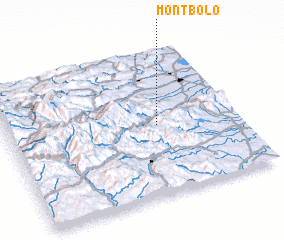 Places with similar names to Montbolo, France ::
// Monte Bello (US)
// Montbello (US)
// Montebello (IT)
// Montebello (ZA)
// Mandaboaly (MG)
// Mandaboaly (MG)
// Mount Beulah (US)
// Montebello (US)
// Montebello (US)
// Mount Beulah (US)
Disclaimer :: Information on this page comes without warranty of any kind |
||
|
Where is Montbolo? Elevation and coordinates ::
Latitude (lat): 42°29'0"N Longitude (lon): 2°39'0"E
Elevation (approx.): 579m (map arrows pan, magnifying glasses zoom) |
||
|
Visiting Montbolo? Hotel/Accommodation ::
Book a hotel in Montbolo Travel Guide ::
Buy a travel guide for France rental cars ::
car rental offers GPS waypoint ::
download a GPX waypoint (PoI) of Montbolo for your GPS receiver
|
||