|
search place name
|
||
Montcheny (Provence-Alpes-Côte dʼAzur, France)Montcheny is a town in the Provence-Alpes-Côte dʼAzur region of France. An overview map of the region around Montcheny is displayed below.
regional and 3d topo map of Montcheny, France ::

Montcheny airports ::
The nearest airport is CUF - Levaldigi, located 103.5 km east of Montcheny.
Other airports nearby include GNB - Grenoble Saint Geoirs (109.4 km north west), VAF - Valence Chabeuil (111.1 km west), CMF - Chambery Aix Les Bains (111.9 km north), TRN - Torino (118.7 km north east), Nearby towns ::
Orcières (0.0km north) //
Les Marches (1.3km west) //
Les Estaris (1.9km north) //
Les Audiberts (2.3km south west) //
Archinard (2.3km south west) //
Forest des Baniols (2.3km north west) //
Prapic (3.2km north east) //
Serre-Eyrauds (4.0km west) //
Les Tourengs (4.0km west) //
Gournier (7.4km south) //
Les Ricoux (5.3km west) //
Clot-Davin (5.6km west) //
Les Eyrauds (5.6km west) //
Les Borels (6.4km north west) //
Les Martins (6.4km north west) //
Les Gubias (6.4km north west) //
[all distances 'as the bird flies' and approximate] 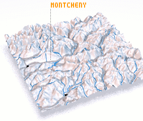 Places with similar names to Montcheny, France ::
// Montchan (US)
// Montechino (IT)
// Mantshiene (CD)
// Manatchenai (LK)
// Mānda Chīna (PK)
// Monticiano (IT)
// Montchenu (FR)
// Montachon (FR)
// Mont-Chenu (FR)
Disclaimer :: Information on this page comes without warranty of any kind |
||
|
Where is Montcheny? Elevation and coordinates ::
Latitude (lat): 44°41'0"N Longitude (lon): 6°20'0"E
Elevation (approx.): 1384m (map arrows pan, magnifying glasses zoom) |
||
|
Visiting Montcheny? Hotel/Accommodation ::
Book a hotel in Montcheny Travel Guide ::
Buy a travel guide for France rental cars ::
car rental offers GPS waypoint ::
download a GPX waypoint (PoI) of Montcheny for your GPS receiver
|
||