|
search place name
|
||
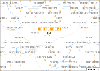
Montgobert (Picardie, France)Montgobert is a town in the Picardie region of France. An overview map of the region around Montgobert is displayed below.
regional and 3d topo map of Montgobert, France ::
Montgobert airports ::
The nearest airport is CSF - Creil, located 46.2 km west of Montgobert.
Other airports nearby include CDG - Paris Charles De Gaulle (54.2 km south west), LBG - Paris Le Bourget (63.4 km south west), RHE - Reims Champagne (65.5 km east), BVA - Beauvais Tille (77.3 km west), Nearby towns ::
Puiseux-en-Retz (1.2km west) //
Soucy (2.2km north west) //
Fleury (3.7km south) //
Coeuvres-et-Valsery (3.7km north) //
Saint-Pierre-Aigle (3.0km north east) //
Dampleux (5.6km south) //
Vivières (3.6km west) //
Laversine (5.7km north) //
Cutry (6.1km north east) //
Faverolles (7.5km south) //
Saint-Bandry (7.5km north) //
Longpont (6.1km south east) //
Mortefontaine (6.1km north west) //
Dommiers (6.1km north east) //
Villers-Cotterêts (7.4km south west) //
Corcy (7.4km south east) //
Montigny-Lengrain (8.3km north west) //
Pisseleux (8.9km south west) //
[all distances 'as the bird flies' and approximate] 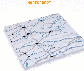 Places with similar names to Montgobert, France :: Disclaimer :: Information on this page comes without warranty of any kind |
||
|
Where is Montgobert? Elevation and coordinates ::
Latitude (lat): 49°18'0"N Longitude (lon): 3°9'0"E
Elevation (approx.): 121m (map arrows pan, magnifying glasses zoom) |
||
|
Visiting Montgobert? Hotel/Accommodation ::
Book a hotel in Montgobert Travel Guide ::
Buy a travel guide for France rental cars ::
car rental offers GPS waypoint ::
download a GPX waypoint (PoI) of Montgobert for your GPS receiver
|
||