|
search place name
|
||
Monthiers (Picardie, France)Monthiers is a town in the Picardie region of France. An overview map of the region around Monthiers is displayed below.
regional and 3d topo map of Monthiers, France ::

Monthiers airports ::
The nearest airport is CDG - Paris Charles De Gaulle, located 55.7 km west of Monthiers.
Other airports nearby include RHE - Reims Champagne (59.4 km north east), CSF - Creil (59.4 km west), LBG - Paris Le Bourget (64.4 km west), ORY - Paris Orly (80.6 km south west), Nearby towns ::
Belleau (0.0km north) //
Bonnesvalyn (2.2km north east) //
Sommelans (3.7km north) //
Licy-Clignon (2.4km west) //
Bouresches (3.7km south) //
Torcy-en-Valois (3.1km south west) //
Courchamps (3.1km north west) //
Étrépilly (3.1km south east) //
Priez (4.4km north west) //
Épaux-Bézu (3.6km east) //
Latilly (5.7km north) //
Bussiares (4.1km south west) //
Lucy-le-Bocage (5.7km south) //
Hautevesnes (5.2km west) //
Grisolles (6.6km north east) //
Neuilly-Saint-Front (7.8km north) //
Coupru (7.8km south) //
La Croix-sur-Ourcq (8.3km north east) //
Macogny (8.9km north west) //
Essômes-sur-Marne (8.9km south east) //
[all distances 'as the bird flies' and approximate] 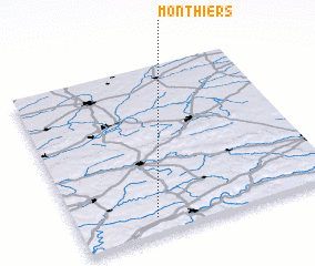 Places with similar names to Monthiers, France ::
Disclaimer :: Information on this page comes without warranty of any kind |
||
|
Where is Monthiers? Elevation and coordinates ::
Latitude (lat): 49°6'0"N Longitude (lon): 3°18'0"E
Elevation (approx.): 128m (map arrows pan, magnifying glasses zoom) |
||
|
Visiting Monthiers? Hotel/Accommodation ::
Book a hotel in Monthiers Travel Guide ::
Buy a travel guide for France rental cars ::
car rental offers GPS waypoint ::
download a GPX waypoint (PoI) of Monthiers for your GPS receiver
|
||