|
search place name
|
||
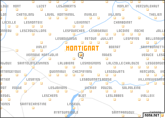
Montignat (Auvergne, France)Montignat is a town in the Auvergne region of France. An overview map of the region around Montignat is displayed below.
regional and 3d topo map of Montignat, France ::
Montignat airports ::
The nearest airport is MCU - Montlucon Domerat, located 34.8 km north west of Montignat.
Other airports nearby include VHY - Vichy Charmeil (36.3 km east), MCU - Montlucon-gueret Montlucon Gueret (44.4 km west), CFE - Clermont Ferrand Auvergne (46.0 km south east), XMU - Moulins Montbeugny (55.7 km north east), Nearby towns ::
Moureuille (1.3km west) //
Échassières (1.9km north) //
Pranoix (2.3km north west) //
Les Bertons (2.3km south west) //
Les Moignons (2.3km south east) //
Le Grand Châtel (3.7km north) //
Chez Fayard (3.7km south) //
Durmignat (3.2km north west) //
Montasseaut (3.2km north west) //
La Lubière (3.2km south west) //
Retour (3.9km north) //
Servant (3.9km south) //
Les Boudards (4.5km north west) //
Le Mazet (4.5km north east) //
Les Quartonnets (4.5km south west) //
Champomier (4.5km south east) //
Nades (3.9km east) //
Les Fourches (5.7km north) //
Les Bournats (5.7km south) //
Crozet (5.7km south) //
Juillat (5.3km north east) //
Les Bideaux (6.1km north east) //
Cambemorel (5.3km south east) //
Les Boudignons (5.3km south west) //
Querriaux (5.3km south west) //
Le Vernet (7.4km north) //
Montjolin (5.1km west) //
Pont-de-Menat (7.4km south) //
Les Chemins (7.5km north) //
[all distances 'as the bird flies' and approximate] 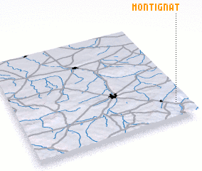 Places with similar names to Montignat, France ::
// Mindègon Te (MM)
// Mandakanda (LK)
// Maundeh Kunda (GM)
// Mendy Kunda (GM)
// Minti Kunda (GM)
// Montagnat (FR)
// Mount Kent (AU)
// Montecanto (BO)
// Mount Kennedy (IE)
// Montignat (FR)
Disclaimer :: Information on this page comes without warranty of any kind |
||
|
Where is Montignat? Elevation and coordinates ::
Latitude (lat): 46°10'0"N Longitude (lon): 2°56'0"E
Elevation (approx.): 648m (map arrows pan, magnifying glasses zoom) |
||
|
Visiting Montignat? Hotel/Accommodation ::
Book a hotel in Montignat Travel Guide ::
Buy a travel guide for France rental cars ::
car rental offers GPS waypoint ::
download a GPX waypoint (PoI) of Montignat for your GPS receiver
|
||