|
search place name
|
||
Montigny (Picardie, France)Montigny is a town in the Picardie region of France. An overview map of the region around Montigny is displayed below.
regional and 3d topo map of Montigny, France ::

Montigny airports ::
The nearest airport is LTQ - Le Tourquet Le Touquet Paris Plage, located 21.3 km north west of Montigny.
Other airports nearby include CQF - Calais Dunkerque (69.4 km north), LYX - Lydd (89.3 km north west), LIL - Lille Lesquin (96.8 km east), BVA - Beauvais Tille (102.7 km south), Nearby towns ::
Nampont-Saint-Martin (1.2km west) //
Roussent (2.2km north east) //
Nempont-Saint-Firmin (2.4km west) //
Vron (3.9km south) //
Le Puits Berrault (4.4km north west) //
Noyelle (3.5km west) //
Bois-Jean (5.7km north) //
LʼAiguille (5.7km north) //
Le Petit Chemin (4.0km south east) //
Maintenay (4.0km north east) //
Lépine (5.1km north west) //
La Houssoye (5.1km north east) //
Argoules (4.7km east) //
Regnière-Écluse (7.4km south) //
Tigny-Noyelle (4.7km west) //
Buire-le-Sec (6.0km north east) //
Ébruyères (6.0km north west) //
Villers-sur-Authie (6.0km south west) //
Wailly-Beaucamp (7.8km north) //
Arry (8.2km south west) //
Vironchaux (8.2km south east) //
Vercourt (7.3km south west) //
[all distances 'as the bird flies' and approximate] 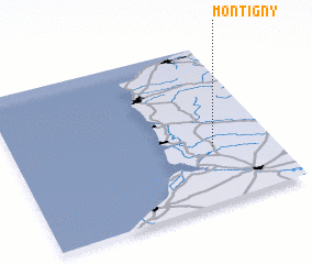 Places with similar names to Montigny, France ::
Disclaimer :: Information on this page comes without warranty of any kind |
||
|
Where is Montigny? Elevation and coordinates ::
Latitude (lat): 50°21'0"N Longitude (lon): 1°46'0"E
Elevation (approx.): 47m (map arrows pan, magnifying glasses zoom) |
||
|
Visiting Montigny? Hotel/Accommodation ::
Book a hotel in Montigny Travel Guide ::
Buy a travel guide for France rental cars ::
car rental offers GPS waypoint ::
download a GPX waypoint (PoI) of Montigny for your GPS receiver
|
||