|
search place name
|
||
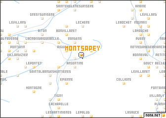
Montsapey (Rhône-Alpes, France)Montsapey is a town in the Rhône-Alpes region of France. An overview map of the region around Montsapey is displayed below.
regional and 3d topo map of Montsapey, France ::
Montsapey airports ::
The nearest airport is CMF - Chambery Aix Les Bains, located 37.9 km west of Montsapey.
Other airports nearby include NCY - Annecy Meythet (49.4 km north), QNJ - Annemasse (75.2 km north), GNB - Grenoble Saint Geoirs (80.4 km west), GVA - Geneva Cointrin (82.1 km north), Nearby towns ::
LʼÉchau (1.3km west) //
Torchet (2.3km north east) //
Argentine (2.3km south west) //
Randens (3.9km north) //
Aiguebelle (3.2km north west) //
Saint-Georges-des-Hurtières (4.3km south west) //
Montgilbert (5.4km north west) //
Bonvillaret (6.1km north west) //
Épierre (6.1km south west) //
Léchère (7.4km north) //
Bonvillard (7.9km north) //
Saint-Alban-des-Hurtières (6.4km south west) //
Saint-Pierre-de-Belleville (7.6km south west) //
[all distances 'as the bird flies' and approximate]  Places with similar names to Montsapey, France ::
// Mandasip (ID)
// Mien-tzu-pu (TW)
Disclaimer :: Information on this page comes without warranty of any kind |
||
|
Where is Montsapey? Elevation and coordinates ::
Latitude (lat): 45°31'0"N Longitude (lon): 6°20'0"E
Elevation (approx.): 726m (map arrows pan, magnifying glasses zoom) |
||
|
Visiting Montsapey? Hotel/Accommodation ::
Book a hotel in Montsapey Travel Guide ::
Buy a travel guide for France rental cars ::
car rental offers GPS waypoint ::
download a GPX waypoint (PoI) of Montsapey for your GPS receiver
|
||