|
search place name
|
||
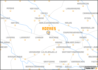
Mormès (Midi-Pyrénées, France)Mormès is a town in the Midi-Pyrénées region of France. An overview map of the region around Mormès is displayed below.
regional and 3d topo map of Mormès, France ::
Mormès airports ::
The nearest airport is PUF - Pau Pyrenees, located 49.8 km south west of Mormès.
Other airports nearby include LDE - Tarbes Lourdes (68.2 km south), AGF - Agen La Garenne (73.6 km north east), BIQ - Biarritz-bayonne Anglet (116.2 km west), XAC - Arcachon La Teste De Buch (118.6 km north west), Nearby towns ::
Perchède (2.3km south east) //
Monlezun-dʼArmagnac (3.7km north) //
Le Houga (3.3km south west) //
Laujuzan (3.3km north east) //
Magnan (4.6km south east) //
Luppé-Violles (5.7km south) //
Toujouse (6.2km north west) //
Lelin-Lapujolle (7.4km south) //
Maupas (7.4km north) //
Arblade-le-Bas (7.5km south) //
Castex (7.5km north) //
Bourdalat (6.9km north west) //
Lanne-Soubiran (6.9km south east) //
Saint-Griède (6.9km south east) //
Monguilhem (7.9km north) //
Panjas (6.5km north east) //
Vergoignan (8.4km south west) //
[all distances 'as the bird flies' and approximate] 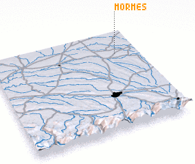 Places with similar names to Mormès, France ::
Disclaimer :: Information on this page comes without warranty of any kind |
||
|
Where is Mormès? Elevation and coordinates ::
Latitude (lat): 43°47'0"N Longitude (lon): 0°9'0"W
Elevation (approx.): 128m (map arrows pan, magnifying glasses zoom) |
||
|
Visiting Mormès? Hotel/Accommodation ::
Book a hotel in Mormès Travel Guide ::
Buy a travel guide for France rental cars ::
car rental offers GPS waypoint ::
download a GPX waypoint (PoI) of Mormès for your GPS receiver
|
||