|
search place name
|
||
Muirancourt (Picardie, France)Muirancourt is a town in the Picardie region of France. An overview map of the region around Muirancourt is displayed below.
regional and 3d topo map of Muirancourt, France ::

Muirancourt airports ::
The nearest airport is CSF - Creil, located 56.2 km south west of Muirancourt.
Other airports nearby include BVA - Beauvais Tille (67.8 km west), CDG - Paris Charles De Gaulle (78.1 km south west), RHE - Reims Champagne (85.0 km south east), LBG - Paris Le Bourget (85.9 km south west), Nearby towns ::
Fréniches (1.9km north) //
Bussy (2.2km south west) //
Frétoy-le-Château (2.2km north west) //
Crisolles (3.9km south) //
Campagne (3.0km south west) //
Beaurains-lès-Noyon (4.4km south west) //
Guiscard (3.6km east) //
Genvry (5.7km south) //
Quesmy (5.2km south east) //
Sermaize (5.2km south west) //
Flavy-le-Meldeux (5.2km north east) //
Libermont (6.1km north west) //
Noyon (7.4km south) //
Grécourt (7.5km north) //
Esmery-Hallon (7.5km north) //
Catigny (5.1km west) //
Berlancourt (5.1km east) //
Vauchelles (7.8km south) //
Buverchy (7.8km north) //
Porquéricourt (7.8km south) //
Le Plessis-Patte-dʼOie (6.1km north east) //
Breuil (8.2km north west) //
Salency (8.2km south east) //
Golancourt (7.3km north east) //
Ercheu (7.3km north west) //
Suzoy (8.8km south west) //
Moyencourt (8.8km north west) //
[all distances 'as the bird flies' and approximate] 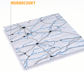 Places with similar names to Muirancourt, France ::
Disclaimer :: Information on this page comes without warranty of any kind |
||
|
Where is Muirancourt? Elevation and coordinates ::
Latitude (lat): 49°39'0"N Longitude (lon): 3°0'0"E
Elevation (approx.): 71m (map arrows pan, magnifying glasses zoom) |
||
|
Visiting Muirancourt? Hotel/Accommodation ::
Book a hotel in Muirancourt Travel Guide ::
Buy a travel guide for France rental cars ::
car rental offers GPS waypoint ::
download a GPX waypoint (PoI) of Muirancourt for your GPS receiver
|
||