|
search place name
|
||
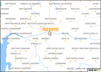
Nicorps (Basse-Normandie, France)Nicorps is a town in the Basse-Normandie region of France. An overview map of the region around Nicorps is displayed below.
regional and 3d topo map of Nicorps, France ::
Nicorps airports ::
The nearest airport is JER - Jersey, located 60.1 km west of Nicorps.
Other airports nearby include CER - Cherbourg Maupertus (68.7 km north), DNR - Dinard Pleurtuit (69.5 km south west), CFR - Caen Carpiquet (72.3 km east), ACI - Alderney (94.6 km north west), Nearby towns ::
Saussey (2.2km south west) //
Coutances (2.2km north west) //
Courcy (2.2km north east) //
Saint-Nicolas-de-Coutances (4.4km north west) //
Monthuchon (5.6km north) //
Belval (3.6km east) //
Orval (4.1km south west) //
Ouville (4.1km south east) //
Contrières (5.7km south) //
Saint-Denis-le-Vêtu (5.7km south) //
Hyenville (5.2km south west) //
Cambernon (6.1km north east) //
Bricqueville-la-Blouette (4.9km west) //
Trelly (7.5km south) //
Le Grand Cambry (7.5km south) //
La Vendelée (6.6km north west) //
Gratot (6.1km north west) //
Quettreville-sur-Sienne (8.3km south west) //
Camprond (7.4km north east) //
Servigny (8.3km north west) //
Ancteville (8.9km north west) //
[all distances 'as the bird flies' and approximate]  Places with similar names to Nicorps, France :: Disclaimer :: Information on this page comes without warranty of any kind |
||
|
Where is Nicorps? Elevation and coordinates ::
Latitude (lat): 49°2'0"N Longitude (lon): 1°25'0"W
Elevation (approx.): 74m (map arrows pan, magnifying glasses zoom) |
||
|
Visiting Nicorps? Hotel/Accommodation ::
Book a hotel in Nicorps Travel Guide ::
Buy a travel guide for France rental cars ::
car rental offers GPS waypoint ::
download a GPX waypoint (PoI) of Nicorps for your GPS receiver
|
||