|
search place name
|
||
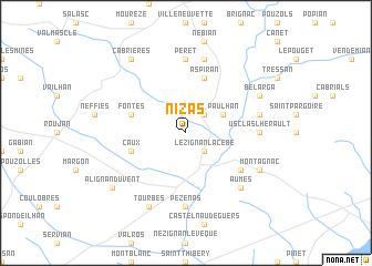
Nizas (Languedoc-Roussillon, France)Nizas is a town in the Languedoc-Roussillon region of France. An overview map of the region around Nizas is displayed below.
regional and 3d topo map of Nizas, France ::
Nizas airports ::
The nearest airport is BZR - Beziers Vias, located 22.1 km south of Nizas.
Other airports nearby include MPL - Montpellier Mediterranee (44.6 km east), FNI - Nimes Garons (85.0 km east), DCM - Castres Mazamet (91.2 km west), CCF - Carcassonne Salvaza (96.0 km west), Nearby towns ::
Adissan (2.3km north east) //
Lézignan-la-Cèbe (2.3km south east) //
Paulhan (3.3km north east) //
Aspiran (5.7km north) //
Fontès (4.4km north west) //
Caux (4.4km south west) //
Cazouls-dʼHérault (5.5km south east) //
Péret (7.4km north) //
Usclas-lʼHérault (5.4km east) //
Pézenas (7.4km south) //
Lieuran-Cabrières (7.5km north) //
Campagnan (5.7km east) //
Aumes (6.9km south east) //
Bélarga (6.5km north east) //
Montagnac (6.5km south east) //
Tourbes (7.9km south) //
Cabrières (8.4km north west) //
Alignan-du-Vent (7.7km south west) //
[all distances 'as the bird flies' and approximate]  Places with similar names to Nizas, France ::
Disclaimer :: Information on this page comes without warranty of any kind |
||
|
Where is Nizas? Elevation and coordinates ::
Latitude (lat): 43°31'0"N Longitude (lon): 3°25'0"E
Elevation (approx.): 78m (map arrows pan, magnifying glasses zoom) |
||
|
Visiting Nizas? Hotel/Accommodation ::
Book a hotel in Nizas Travel Guide ::
Buy a travel guide for France rental cars ::
car rental offers GPS waypoint ::
download a GPX waypoint (PoI) of Nizas for your GPS receiver
|
||