|
search place name
|
||
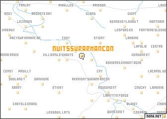
Nuits-sur-Armançon (Bourgogne, France)Nuits-sur-Armançon is a town in the Bourgogne region of France. An overview map of the region around Nuits-sur-Armançon is displayed below.
regional and 3d topo map of Nuits-sur-Armançon, France ::
Nuits-sur-Armançon airports ::
The nearest airport is AUF - Auxerre Branches, located 54.2 km west of Nuits-sur-Armançon.
Other airports nearby include QYR - Troyes Barberey (66.9 km north), DIJ - Dijon Longvic (84.6 km south east), XCD - Chalon Champforgeuil (111.2 km south east), NVS - Nevers Fourchambault (115.5 km south west), Nearby towns ::
Ravières (1.2km east) //
Chassignelles (2.2km north west) //
Fulvy (2.5km west) //
Cry (4.5km south east) //
Cusy (4.5km north west) //
Stigny (4.5km north east) //
Ancy-le-Franc (4.5km north west) //
Villiers-les-Hauts (3.7km west) //
Perrigny-sur-Armançon (5.7km south) //
Rougemont (8.3km south east) //
Étivey (8.3km south west) //
[all distances 'as the bird flies' and approximate] 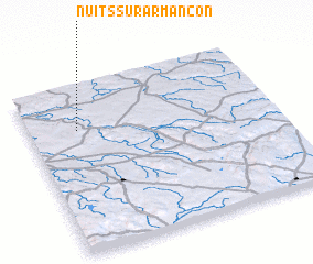 Places with similar names to Nuits-sur-Armançon, France :: Disclaimer :: Information on this page comes without warranty of any kind |
||
|
Where is Nuits-sur-Armançon? Elevation and coordinates ::
Latitude (lat): 47°44'0"N Longitude (lon): 4°12'0"E
Elevation (approx.): 211m (map arrows pan, magnifying glasses zoom) |
||
|
Visiting Nuits-sur-Armançon? Hotel/Accommodation ::
Book a hotel in Nuits-sur-Armançon Travel Guide ::
Buy a travel guide for France rental cars ::
car rental offers GPS waypoint ::
download a GPX waypoint (PoI) of Nuits-sur-Armançon for your GPS receiver
|
||