|
search place name
|
||
Oigny (Bourgogne, France)Oigny is a town in the Bourgogne region of France. An overview map of the region around Oigny is displayed below.
regional and 3d topo map of Oigny, France ::

Oigny airports ::
The nearest airport is DIJ - Dijon Longvic, located 43.5 km south east of Oigny.
Other airports nearby include DLE - Dole Tavaux (79.6 km south east), XCD - Chalon Champforgeuil (82.7 km south), AUF - Auxerre Branches (96.8 km west), QYR - Troyes Barberey (98.9 km north west), Nearby towns ::
Les Granges (1.9km north) //
Laperrière (3.1km north west) //
Billy-lès-Chanceaux (3.9km south) //
Courceau (3.9km south) //
Orret (4.5km north west) //
Poiseul-la-Ville-et-Laperrière (3.8km west) //
Chanceaux (5.7km south) //
Gronet (7.5km north) //
Grand Vallée (5.3km east) //
Saint-Germain-Source-Seine (7.5km south) //
Étalante (7.8km north) //
Vaubuzin (7.5km south west) //
Poncey-sur-lʼIgnon (8.3km south east) //
Ampilly-le-Haut (8.9km north west) //
Pellerey (8.9km south east) //
[all distances 'as the bird flies' and approximate] 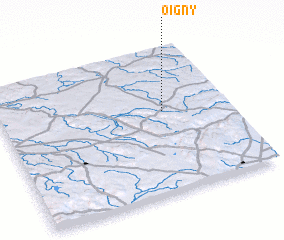 Places with similar names to Oigny, France ::
Disclaimer :: Information on this page comes without warranty of any kind |
||
|
Where is Oigny? Elevation and coordinates ::
Latitude (lat): 47°34'0"N Longitude (lon): 4°43'0"E
Elevation (approx.): 389m (map arrows pan, magnifying glasses zoom) |
||
|
Visiting Oigny? Hotel/Accommodation ::
Book a hotel in Oigny Travel Guide ::
Buy a travel guide for France rental cars ::
car rental offers GPS waypoint ::
download a GPX waypoint (PoI) of Oigny for your GPS receiver
|
||