|
search place name
|
||
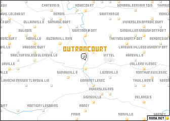
Outrancourt (Lorraine, France)Outrancourt is a town in the Lorraine region of France. An overview map of the region around Outrancourt is displayed below.
regional and 3d topo map of Outrancourt, France ::
Outrancourt airports ::
The nearest airport is EPL - Epinal Mirecourt, located 18.8 km north east of Outrancourt.
Other airports nearby include ENC - Nancy Essey (59.9 km north east), ETZ - Metz Nancy Lorraine (90.8 km north), MZM - Metz Frescaty (98.4 km north), CMR - Colmar Houssen (109.0 km east), Nearby towns ::
Mandres-sur-Vair (1.9km north) //
Contrexéville (1.9km south) //
Norroy (2.2km north east) //
Suriauville (4.5km south west) //
Saint-Remimont (5.6km north) //
Belmont-sur-Vair (5.6km north) //
Vittel (3.7km east) //
Dombrot-le-Sec (5.7km south) //
Auzainvilliers (5.2km north west) //
Lignéville (5.2km south east) //
Dombrot-sur-Vair (7.5km north) //
Bulgnéville (5.3km west) //
Parey-sous-Montfort (6.7km north east) //
Viviers-le-Gras (7.8km south) //
Sandaucourt (8.3km north west) //
Crainvilliers (7.4km south west) //
Provenchères-lès-Darney (8.3km south east) //
[all distances 'as the bird flies' and approximate]  Places with similar names to Outrancourt, France ::
// Outer Ring Road (KE)
Disclaimer :: Information on this page comes without warranty of any kind |
||
|
Where is Outrancourt? Elevation and coordinates ::
Latitude (lat): 48°12'0"N Longitude (lon): 5°54'0"E
Elevation (approx.): 325m (map arrows pan, magnifying glasses zoom) |
||
|
Visiting Outrancourt? Hotel/Accommodation ::
Book a hotel in Outrancourt Travel Guide ::
Buy a travel guide for France rental cars ::
car rental offers GPS waypoint ::
download a GPX waypoint (PoI) of Outrancourt for your GPS receiver
|
||