|
search place name
|
||
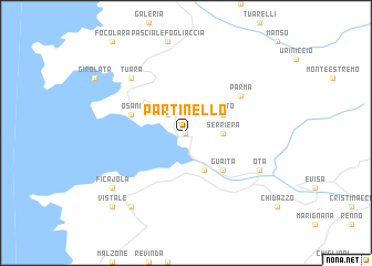
Partinello (France)Partinello is a town in France. An overview map of the region around Partinello is displayed below.
regional and 3d topo map of Partinello, France ::
Partinello airports ::
The nearest airport is CLY - Calvi Saint Catherine, located 27.2 km north of Partinello.
Other airports nearby include AJA - Ajaccio Campo Dell Oro (43.0 km south), BIA - Bastia Poretta (71.6 km north east), SOZ - Solenzara (72.9 km south east), FSC - Figari Sud Corse (95.2 km south), Nearby towns ::
Vitriccia (0.0km north) //
Curzo (2.3km north west) //
Serriera (2.7km east) //
Porto (4.0km south) //
Pinito (3.3km north east) //
Guaita (4.6km south east) //
Osani (4.5km north west) //
Parma (5.5km north east) //
Tuara (6.9km north west) //
Ota (6.6km south east) //
Ficajola (7.8km south west) //
Piana (8.5km south west) //
Vistale (9.2km south west) //
[all distances 'as the bird flies' and approximate]  Places with similar names to Partinello, France ::
Disclaimer :: Information on this page comes without warranty of any kind |
||
|
Where is Partinello? Elevation and coordinates ::
Latitude (lat): 42°18'0"N Longitude (lon): 8°41'0"E
Elevation (approx.): 315m (map arrows pan, magnifying glasses zoom) |
||
|
Visiting Partinello? Hotel/Accommodation ::
Book a hotel in Partinello Travel Guide ::
Buy a travel guide for France rental cars ::
car rental offers GPS waypoint ::
download a GPX waypoint (PoI) of Partinello for your GPS receiver
|
||