|
search place name
|
||
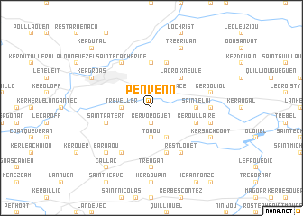
Penvenn (Bretagne, France)Penvenn is a town in the Bretagne region of France. An overview map of the region around Penvenn is displayed below.
regional and 3d topo map of Penvenn, France ::
Penvenn airports ::
The nearest airport is MXN - Morlaix Ploujean, located 45.1 km north west of Penvenn.
Other airports nearby include LRT - Lorient Lann Bihoue (54.7 km south), LAI - Lannion (56.2 km north), UIP - Quimper Pluguffan (57.3 km south west), SBK - St.-brieuc Armor Armor (58.6 km north east), Nearby towns ::
Kervoroguet (1.9km south) //
Le Moustoir (2.2km north east) //
Pors-an-Place (2.2km north east) //
Tréveller (2.5km west) //
Tohou (3.7km south) //
Plévin (3.9km south) //
La Croix-Neuve (4.5km north east) //
Treffrin (5.6km north) //
Saint-Éloi (3.7km east) //
La Boissière-banal (5.7km north) //
Poulloudu (5.7km south) //
Saint-Patern (4.1km south west) //
Keroullaire (4.1km south east) //
Sainte-Catherine (6.1km north west) //
Motreff (6.1km south west) //
Rest-louët (6.1km south east) //
Tréogan (7.4km south) //
Quehelan (4.9km east) //
Keroguiou (5.3km east) //
Paule (5.3km east) //
Barnaou (6.7km south west) //
Carhaix-Plouguer (6.2km north west) //
Kergroas (6.2km north west) //
Kersachcoat (6.2km south east) //
Trébrivan (7.8km north) //
Callac (8.3km south west) //
Kerdutal (8.9km north west) //
[all distances 'as the bird flies' and approximate] 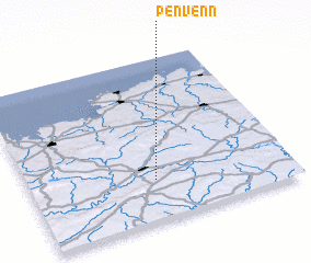 Places with similar names to Penvenn, France ::
Disclaimer :: Information on this page comes without warranty of any kind |
||
|
Where is Penvenn? Elevation and coordinates ::
Latitude (lat): 48°15'0"N Longitude (lon): 3°31'0"W
Elevation (approx.): 130m (map arrows pan, magnifying glasses zoom) |
||
|
Visiting Penvenn? Hotel/Accommodation ::
Book a hotel in Penvenn Travel Guide ::
Buy a travel guide for France rental cars ::
car rental offers GPS waypoint ::
download a GPX waypoint (PoI) of Penvenn for your GPS receiver
|
||