|
search place name
|
||
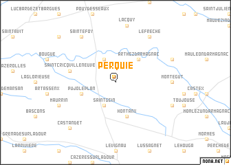
Perquie (Aquitaine, France)Perquie is a town in the Aquitaine region of France. An overview map of the region around Perquie is displayed below.
regional and 3d topo map of Perquie, France ::
Perquie airports ::
The nearest airport is PUF - Pau Pyrenees, located 55.2 km south of Perquie.
Other airports nearby include AGF - Agen La Garenne (78.0 km north east), LDE - Tarbes Lourdes (79.6 km south), XAC - Arcachon La Teste De Buch (104.6 km north west), BIQ - Biarritz-bayonne Anglet (109.4 km south west), Nearby towns ::
Villeneuve-de-Marsan (3.9km north) //
Saint-Gein (3.9km south) //
Arthez-dʼArmagnac (4.6km north east) //
Hontanx (5.7km south) //
Pujo-le-Plan (4.4km south west) //
Saint-Cricq-Villeneuve (5.7km west) //
Sainte-Foy (8.4km north west) //
Le Frèche (8.4km north east) //
Castandet (9.1km south west) //
[all distances 'as the bird flies' and approximate] 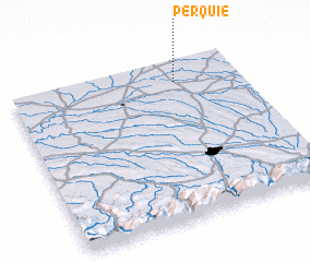 Places with similar names to Perquie, France ::
Disclaimer :: Information on this page comes without warranty of any kind |
||
|
Where is Perquie? Elevation and coordinates ::
Latitude (lat): 43°52'0"N Longitude (lon): 0°17'0"W
Elevation (approx.): 85m (map arrows pan, magnifying glasses zoom) |
||
|
Visiting Perquie? Hotel/Accommodation ::
Book a hotel in Perquie Travel Guide ::
Buy a travel guide for France rental cars ::
car rental offers GPS waypoint ::
download a GPX waypoint (PoI) of Perquie for your GPS receiver
|
||