|
search place name
|
||
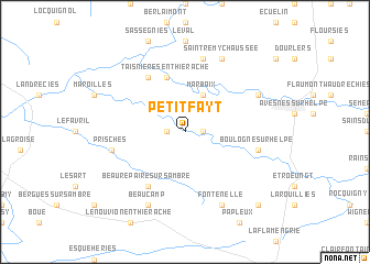
Petit-Fayt (Nord-Pas-de-Calais, France)Petit-Fayt is a town in the Nord-Pas-de-Calais region of France. An overview map of the region around Petit-Fayt is displayed below.
regional and 3d topo map of Petit-Fayt, France ::
Petit-Fayt airports ::
The nearest airport is CRL - Charleroi Brussels South, located 59.6 km north east of Petit-Fayt.
Other airports nearby include LIL - Lille Lesquin (73.8 km north west), RHE - Reims Champagne (89.2 km south), QKT - Kortrijk-vevelgem Wevelgem (91.4 km north west), BRU - Brussels Natl (Melsbroek) (100.4 km north east), Nearby towns ::
Grand-Fayt (1.2km west) //
Cartignies (1.2km east) //
Marbaix (3.9km north) //
Taisnières-en-Thiérache (5.7km north) //
Noyelles-sur-Sambre (6.0km north west) //
Beaurepaire-sur-Sambre (6.0km south west) //
Prisches (5.1km west) //
Monceau-Saint-Waast (7.5km north) //
Boulogne-sur-Helpe (5.1km east) //
Saint-Hilaire-sur-Helpe (6.0km north east) //
Beaucamp (7.8km south) //
Saint-Remy-Chaussée (7.8km north) //
Fontenelle (7.8km south) //
Floyon (8.8km south east) //
[all distances 'as the bird flies' and approximate] 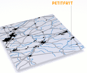 Places with similar names to Petit-Fayt, France ::
// Petit Fouet (GF)
Disclaimer :: Information on this page comes without warranty of any kind |
||
|
Where is Petit-Fayt? Elevation and coordinates ::
Latitude (lat): 50°6'0"N Longitude (lon): 3°50'0"E
Elevation (approx.): 144m (map arrows pan, magnifying glasses zoom) |
||
|
Visiting Petit-Fayt? Hotel/Accommodation ::
Book a hotel in Petit-Fayt Travel Guide ::
Buy a travel guide for France rental cars ::
car rental offers GPS waypoint ::
download a GPX waypoint (PoI) of Petit-Fayt for your GPS receiver
|
||