|
search place name
|
||
Philondenx (Aquitaine, France)Philondenx is a town in the Aquitaine region of France. An overview map of the region around Philondenx is displayed below.
regional and 3d topo map of Philondenx, France ::

Philondenx airports ::
The nearest airport is PUF - Pau Pyrenees, located 20.9 km south of Philondenx.
Other airports nearby include LDE - Tarbes Lourdes (56.1 km south east), BIQ - Biarritz-bayonne Anglet (87.5 km west), AGF - Agen La Garenne (107.5 km north east), EAS - San Sebastian (111.0 km west), Nearby towns ::
Malaussanne (1.3km west) //
Cabidos (2.3km south west) //
Lacajunte (4.6km north east) //
Arzacq-Arraziguet (4.6km south east) //
Montagut (4.0km west) //
Arboucave (5.7km north) //
Vignes (6.2km south east) //
Puyol-Cazalet (5.5km north east) //
Louvigny (7.4km south) //
Monget (5.4km west) //
Mant (5.7km west) //
Garos (7.5km south) //
Piets-Plasence-Moustrou (6.9km south west) //
Payros-Cazautets (6.9km north east) //
Samadet (7.9km north) //
Méracq (7.7km south east) //
Bouillon (8.4km south west) //
Mialos (8.4km south east) //
Clèdes (7.7km north east) //
[all distances 'as the bird flies' and approximate] 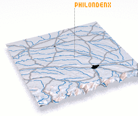 Places with similar names to Philondenx, France ::
// Valea Întunecoasă (RO)
// Valea Întunecoasă (RO)
Disclaimer :: Information on this page comes without warranty of any kind |
||
|
Where is Philondenx? Elevation and coordinates ::
Latitude (lat): 43°34'0"N Longitude (lon): 0°27'0"W
Elevation (approx.): 214m (map arrows pan, magnifying glasses zoom) |
||
|
Visiting Philondenx? Hotel/Accommodation ::
Book a hotel in Philondenx Travel Guide ::
Buy a travel guide for France rental cars ::
car rental offers GPS waypoint ::
download a GPX waypoint (PoI) of Philondenx for your GPS receiver
|
||