|
search place name
|
||
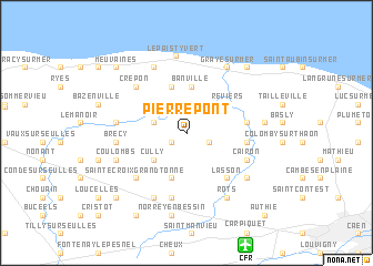
Pierrepont (Basse-Normandie, France)Pierrepont is a town in the Basse-Normandie region of France. An overview map of the region around Pierrepont is displayed below.
regional and 3d topo map of Pierrepont, France ::
Pierrepont airports ::
The nearest airport is CFR - Caen Carpiquet, located 11.9 km south of Pierrepont.
Other airports nearby include DOL - Deauville St Gatien (48.9 km east), LEH - Le Havre Octeville (51.7 km north east), CER - Cherbourg Maupertus (81.6 km north west), URO - Rouen Vallee De Seine (122.6 km east), Nearby towns ::
Lantheuil (1.3km south west) //
Le Fresne-Camilly (1.7km south east) //
Colombiers-sur-Seulles (3.0km north) //
Creully (2.4km north west) //
Tierceville (2.4km north west) //
Amblie (3.2km north east) //
Cully (3.4km south west) //
Banville (4.7km north) //
Secqueville-en-Bessin (4.7km south) //
Sainte-Croix-sur-Mer (4.8km north) //
Reviers (3.9km north east) //
Thaon (4.0km east) //
Fontaine-Henry (4.0km east) //
Lasson (5.3km south east) //
Cairon (4.7km south east) //
Bretteville-lʼOrgueilleuse (6.5km south) //
Sainte-Croix-Grand-Tonne (5.7km south west) //
Crépon (5.8km north west) //
Brécy (4.7km west) //
Villiers-le-Sec (4.7km west) //
Saint-Gabriel (4.7km west) //
Putot-en-Bessin (6.8km south) //
Ver-sur-Mer (6.9km north) //
Rosel (6.0km south east) //
Coulombs (5.3km south west) //
Rots (7.0km south east) //
Graye-sur-Mer (7.1km north) //
Le Paisty-Vert (7.7km north) //
Bény-sur-Mer (5.2km east) //
[all distances 'as the bird flies' and approximate] 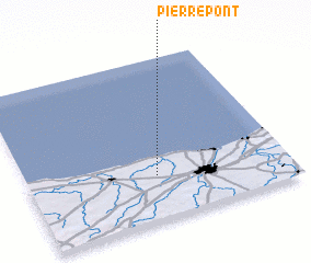 Places with similar names to Pierrepont, France ::
// Pêro Ponto (PT)
// Parpaniţa (RO)
// Pîrî Pîntei (RO)
// Perry Point (US)
// Pierpont (US)
// Pierrepont (US)
// Pierpont (US)
// Pierpont (US)
// Pierpont (US)
// Pīrpainti (IN)
Disclaimer :: Information on this page comes without warranty of any kind |
||
|
Where is Pierrepont? Elevation and coordinates ::
Latitude (lat): 49°16'28"N Longitude (lon): 0°30'13"W
Elevation (approx.): 20m (map arrows pan, magnifying glasses zoom) |
||
|
Visiting Pierrepont? Hotel/Accommodation ::
Book a hotel in Pierrepont Travel Guide ::
Buy a travel guide for France rental cars ::
car rental offers GPS waypoint ::
download a GPX waypoint (PoI) of Pierrepont for your GPS receiver
|
||