|
search place name
|
||
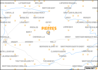
Pierres (Basse-Normandie, France)Pierres is a town in the Basse-Normandie region of France. An overview map of the region around Pierres is displayed below.
regional and 3d topo map of Pierres, France ::
Pierres airports ::
The nearest airport is CFR - Caen Carpiquet, located 39.9 km north east of Pierres.
Other airports nearby include DOL - Deauville St Gatien (85.3 km north east), LVA - Laval Entrammes (92.9 km south), LEH - Le Havre Octeville (95.3 km north east), CER - Cherbourg Maupertus (102.3 km north west), Nearby towns ::
Le Theil (2.2km north east) //
Estry (3.7km north) //
Rully (3.9km south) //
Chênedollé (3.1km south west) //
Bernières-le-Patry (5.6km south) //
Presles (4.1km north west) //
Montchamp (6.1km north west) //
Burcy (4.9km west) //
La Rocque (5.2km east) //
Vassy (5.2km east) //
Moncy (6.7km south east) //
Clairefougère (7.8km south) //
Viessoix (6.1km south west) //
Saint-Charles-de-Percy (8.3km north west) //
Lassy (7.4km north east) //
[all distances 'as the bird flies' and approximate] 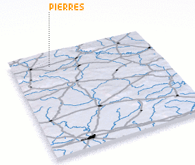 Places with similar names to Pierres, France ::
Disclaimer :: Information on this page comes without warranty of any kind |
||
|
Where is Pierres? Elevation and coordinates ::
Latitude (lat): 48°52'0"N Longitude (lon): 0°44'0"W
Elevation (approx.): 209m (map arrows pan, magnifying glasses zoom) |
||
|
Visiting Pierres? Hotel/Accommodation ::
Book a hotel in Pierres Travel Guide ::
Buy a travel guide for France rental cars ::
car rental offers GPS waypoint ::
download a GPX waypoint (PoI) of Pierres for your GPS receiver
|
||