|
search place name
|
||
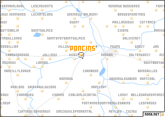
Poncins (Rhône-Alpes, France)Poncins is a town in the Rhône-Alpes region of France. An overview map of the region around Poncins is displayed below.
regional and 3d topo map of Poncins, France ::
Poncins airports ::
The nearest airport is EBU - St.-etienne Boutheon, located 23.7 km south east of Poncins.
Other airports nearby include RNE - Roanne Renaison (38.3 km north), XVF - Vilefrance Tarare (40.9 km north east), LYN - Lyon Bron (60.5 km east), LYS - Lyon Saint Exupery (71.9 km east), Nearby towns ::
Vizezy (1.3km west) //
Naconne (2.3km north east) //
Petit Coincet (2.3km north west) //
Chambéon (3.9km south) //
Cleppé (3.9km north) //
Villedieu (3.2km north west) //
Sainte-Foy-Saint-Sulpice (4.5km north west) //
Randan (3.9km east) //
Saint-Laurent-la-Conche (6.1km south east) //
Mornand (6.1km south west) //
Magneux-Haute-Rive (7.4km south) //
Mizérieux (7.4km north) //
Jullieux (5.2km west) //
Feurs (5.5km east) //
Sugny (7.5km north) //
Nervieux (7.5km north) //
Marclopt (7.9km south) //
Épercieux-Saint-Paul (8.4km north east) //
Pouilly-les-Feurs (9.0km north east) //
[all distances 'as the bird flies' and approximate] 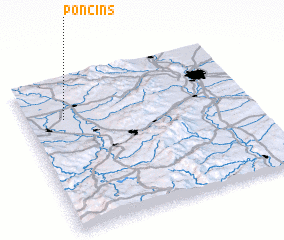 Places with similar names to Poncins, France ::
Disclaimer :: Information on this page comes without warranty of any kind |
||
|
Where is Poncins? Elevation and coordinates ::
Latitude (lat): 45°44'0"N Longitude (lon): 4°10'0"E
Elevation (approx.): 332m (map arrows pan, magnifying glasses zoom) |
||
|
Visiting Poncins? Hotel/Accommodation ::
Book a hotel in Poncins Travel Guide ::
Buy a travel guide for France rental cars ::
car rental offers GPS waypoint ::
download a GPX waypoint (PoI) of Poncins for your GPS receiver
|
||