|
search place name
|
||
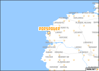
Porspoder (Bretagne, France)Porspoder is a town in the Bretagne region of France. An overview map of the region around Porspoder is displayed below.
regional and 3d topo map of Porspoder, France ::
Porspoder airports ::
The nearest airport is BES - Brest Guipavas, located 26.4 km east of Porspoder.
Other airports nearby include MXN - Morlaix Ploujean (71.1 km east), UIP - Quimper Pluguffan (73.4 km south east), LAI - Lannion (99.6 km east), LRT - Lorient Lann Bihoue (128.5 km south east), Nearby towns ::
Kervezennec (0.0km north) //
Le Vourch (1.9km north) //
Melon (1.9km south) //
Argenton (2.2km north east) //
Lanildut (2.2km south east) //
Perros (3.7km south) //
Larret (2.5km east) //
Kerglonou (3.9km south) //
Landunvez (4.4km north east) //
Kergonsoch (5.6km south) //
Lampaul-Plouarzel (5.6km south) //
Kerguerézec (5.6km south) //
Brélès (4.1km south east) //
Kergastel (4.1km north east) //
Kerzéoc (4.1km south east) //
Rubian (7.4km south) //
Kersaint (6.7km north east) //
Trémazan (6.7km north east) //
Kervinic (7.8km south) //
Plouarzel (7.8km south) //
Portsall (7.4km north east) //
Kerescat (7.4km north east) //
Kerguenegan (8.9km north east) //
[all distances 'as the bird flies' and approximate]  Places with similar names to Porspoder, France :: Disclaimer :: Information on this page comes without warranty of any kind |
||
|
Where is Porspoder? Elevation and coordinates ::
Latitude (lat): 48°30'0"N Longitude (lon): 4°46'0"W
Elevation (approx.): 30m (map arrows pan, magnifying glasses zoom) |
||
|
Visiting Porspoder? Hotel/Accommodation ::
Book a hotel in Porspoder Travel Guide ::
Buy a travel guide for France rental cars ::
car rental offers GPS waypoint ::
download a GPX waypoint (PoI) of Porspoder for your GPS receiver
|
||