|
search place name
|
||
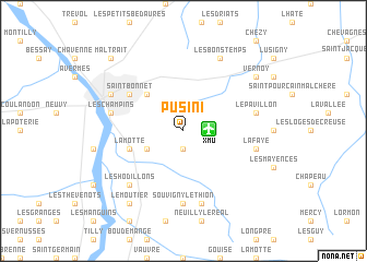
Pusini (Auvergne, France)Pusini is a town in the Auvergne region of France. An overview map of the region around Pusini is displayed below.
regional and 3d topo map of Pusini, France ::
Pusini airports ::
The nearest airport is XMU - Moulins Montbeugny, located 1.8 km east of Pusini.
Other airports nearby include VHY - Vichy Charmeil (40.4 km south), NVS - Nevers Fourchambault (56.6 km north west), MCU - Montlucon Domerat (66.8 km west), RNE - Roanne Renaison (70.2 km south east), Nearby towns ::
Les Ségauds (1.9km south) //
Toulon-sur-Allier (3.2km south west) //
Marcellange (4.5km north west) //
La Motte (4.3km south west) //
Saint-Bonnet (5.3km north west) //
Yzeure (5.3km north west) //
Souvigny le Thion (7.4km south) //
La Pépie (7.5km south) //
La Faye (5.4km east) //
Les Champins (5.4km west) //
Les Bataillots (5.4km west) //
Le Pavillon (5.4km east) //
Les Hodillons (6.7km south west) //
Les Bons Temps (7.8km north) //
Moulins (6.3km north west) //
Le Moutier (8.3km south west) //
Vernoy (7.5km north east) //
Maltrait (9.0km north west) //
[all distances 'as the bird flies' and approximate] 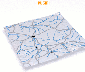 Places with similar names to Pusini, France ::
Disclaimer :: Information on this page comes without warranty of any kind |
||
|
Where is Pusini? Elevation and coordinates ::
Latitude (lat): 46°32'0"N Longitude (lon): 3°24'0"E
Elevation (approx.): 259m (map arrows pan, magnifying glasses zoom) |
||
|
Visiting Pusini? Hotel/Accommodation ::
Book a hotel in Pusini Travel Guide ::
Buy a travel guide for France rental cars ::
car rental offers GPS waypoint ::
download a GPX waypoint (PoI) of Pusini for your GPS receiver
|
||