|
search place name
|
||
Puy-de-Fourches (Aquitaine, France)Puy-de-Fourches is a town in the Aquitaine region of France. An overview map of the region around Puy-de-Fourches is displayed below.
regional and 3d topo map of Puy-de-Fourches, France ::

Puy-de-Fourches airports ::
The nearest airport is PGX - Perigueux Bassillac, located 16.3 km south east of Puy-de-Fourches.
Other airports nearby include EGC - Bergerac Roumaniere (54.0 km south), ANG - Angouleme Brie Champniers (59.0 km north west), BVE - Brive La Roche (65.2 km east), LIG - Limoges Bellegarde (74.3 km north east), Nearby towns ::
La Besse (1.9km north) //
Sencenac-Puy-de-Fourches (2.6km east) //
Lasserre (3.9km north) //
Biras (3.2km south west) //
Les Eyssards (4.5km north east) //
Le Peyrac (3.9km east) //
Château-lʼÉvêque (5.7km south) //
Puyjoubert (5.7km north) //
Preyssac-dʼAgonac (5.4km south east) //
Valeuil (5.4km north west) //
La Lande (6.1km south west) //
Lafarerie (5.5km east) //
Les Roches (7.5km north) //
Bourdeilles (5.5km west) //
Brantôme (7.5km north) //
Bussac (6.4km south west) //
La Chapelle-Gonaguet (8.4km south west) //
Sourbarie (9.1km south east) //
[all distances 'as the bird flies' and approximate] 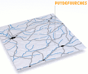 Places with similar names to Puy-de-Fourches, France :: Disclaimer :: Information on this page comes without warranty of any kind |
||
|
Where is Puy-de-Fourches? Elevation and coordinates ::
Latitude (lat): 45°18'0"N Longitude (lon): 0°40'0"W
Elevation (approx.): 224m (map arrows pan, magnifying glasses zoom) |
||
|
Visiting Puy-de-Fourches? Hotel/Accommodation ::
Book a hotel in Puy-de-Fourches Travel Guide ::
Buy a travel guide for France rental cars ::
car rental offers GPS waypoint ::
download a GPX waypoint (PoI) of Puy-de-Fourches for your GPS receiver
|
||