|
search place name
|
||
Rammersmatt (Alsace, France)Rammersmatt is a town in the Alsace region of France. An overview map of the region around Rammersmatt is displayed below.
regional and 3d topo map of Rammersmatt, France ::

Rammersmatt airports ::
The nearest airport is CMR - Colmar Houssen, located 40.8 km north east of Rammersmatt.
Other airports nearby include MLH - Bale Mulhouse (41.9 km south east), SXB - Strassbourg Entzheim (92.1 km north east), EPL - Epinal Mirecourt (94.5 km north west), BRN - Bern Belp (103.7 km south), Nearby towns ::
Bourbach-le-Bas (1.9km south) //
Roderen (2.2km south east) //
Thann (2.2km north east) //
Leimbach (2.5km east) //
Bourbach-le-Haut (2.5km west) //
Bitschwiller-lès-Thann (3.9km north) //
Sentheim (5.6km south) //
Guewenheim (5.7km south) //
Willer-sur-Thur (5.7km north) //
Oleyres (5.7km north) //
Michelbach (5.3km south east) //
Mortzwiller (6.1km south west) //
Vieux-Thann (5.0km east) //
Soppe-le-Haut (7.4km south) //
Aspach-le-Haut (5.3km east) //
Masevaux (5.3km west) //
Lauw (6.7km south west) //
Malmerspach (7.8km north) //
Moosch (7.8km north) //
Mitzach (8.9km north west) //
[all distances 'as the bird flies' and approximate] 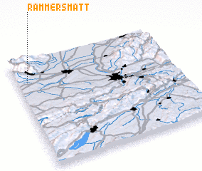 Places with similar names to Rammersmatt, France :: Disclaimer :: Information on this page comes without warranty of any kind |
||
|
Where is Rammersmatt? Elevation and coordinates ::
Latitude (lat): 47°48'0"N Longitude (lon): 7°4'0"E
Elevation (approx.): 613m (map arrows pan, magnifying glasses zoom) |
||
|
Visiting Rammersmatt? Hotel/Accommodation ::
Book a hotel in Rammersmatt Travel Guide ::
Buy a travel guide for France rental cars ::
car rental offers GPS waypoint ::
download a GPX waypoint (PoI) of Rammersmatt for your GPS receiver
|
||