|
search place name
|
||
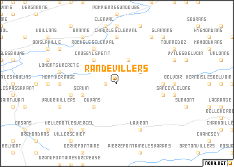
Randevillers (Franche-Comté, France)Randevillers is a town in the Franche-Comté region of France. An overview map of the region around Randevillers is displayed below.
regional and 3d topo map of Randevillers, France ::
Randevillers airports ::
The nearest airport is MLH - Bale Mulhouse, located 82.2 km east of Randevillers.
Other airports nearby include BRN - Bern Belp (86.8 km south east), DLE - Dole Tavaux (88.2 km west), DIJ - Dijon Longvic (108.0 km west), CMR - Colmar Houssen (108.5 km north east), Nearby towns ::
Vellevans (1.3km west) //
Chazot (3.1km north east) //
Orve (3.1km north east) //
Crosey-le-Grand (3.9km north) //
Crosey-le-Petit (4.5km north west) //
Ouvans (4.5km south west) //
Servin (4.2km south west) //
Roche-lès-Clerval (6.1km north west) //
Chaux-lès-Clerval (7.4km north) //
Rahon (5.0km east) //
Sancey-le-Grand (5.4km east) //
Lanans (5.4km west) //
Laviron (7.8km south) //
Anteuil (8.3km north east) //
Branne (8.3km north west) //
Landresse (8.3km south west) //
Glainans (9.0km north east) //
Vellerot-lès-Vercel (9.0km south west) //
[all distances 'as the bird flies' and approximate]  Places with similar names to Randevillers, France :: Disclaimer :: Information on this page comes without warranty of any kind |
||
|
Where is Randevillers? Elevation and coordinates ::
Latitude (lat): 47°19'0"N Longitude (lon): 6°31'0"E
Elevation (approx.): 500m (map arrows pan, magnifying glasses zoom) |
||
|
Visiting Randevillers? Hotel/Accommodation ::
Book a hotel in Randevillers Travel Guide ::
Buy a travel guide for France rental cars ::
car rental offers GPS waypoint ::
download a GPX waypoint (PoI) of Randevillers for your GPS receiver
|
||