|
search place name
|
||
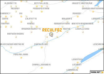
Reculfoz (Franche-Comté, France)Reculfoz is a town in the Franche-Comté region of France. An overview map of the region around Reculfoz is displayed below.
regional and 3d topo map of Reculfoz, France ::
Reculfoz airports ::
The nearest airport is GVA - Geneva Cointrin, located 51.4 km south of Reculfoz.
Other airports nearby include QNJ - Annemasse (57.2 km south), DLE - Dole Tavaux (66.8 km north west), NCY - Annecy Meythet (85.8 km south), XBK - Bourg Ceyzeriat (86.2 km south west), Nearby towns ::
Petite Chaux (1.3km east) //
Le Crouzet (1.3km west) //
Les Pontets (2.2km north east) //
La Chaux Neuve (2.2km south west) //
Rondefontaine (4.5km north east) //
Châtelblanc (4.5km south west) //
Mouthe (4.2km north east) //
Cerniébaud (5.3km north west) //
Arsure-Arsurette (5.4km west) //
Boujeons (6.7km north east) //
Fraroz (6.3km north west) //
Foncine-le-Haut (6.3km south west) //
La Latette (7.5km north west) //
[all distances 'as the bird flies' and approximate] 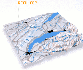 Places with similar names to Reculfoz, France ::
// Hrkalovići (HR)
// Hrkalovići (HR)
Disclaimer :: Information on this page comes without warranty of any kind |
||
|
Where is Reculfoz? Elevation and coordinates ::
Latitude (lat): 46°42'0"N Longitude (lon): 6°9'0"E
Elevation (approx.): 1074m (map arrows pan, magnifying glasses zoom) |
||
|
Visiting Reculfoz? Hotel/Accommodation ::
Book a hotel in Reculfoz Travel Guide ::
Buy a travel guide for France rental cars ::
car rental offers GPS waypoint ::
download a GPX waypoint (PoI) of Reculfoz for your GPS receiver
|
||