|
search place name
|
||
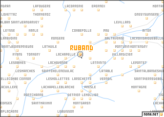
Ruband (Rhône-Alpes, France)Ruband is a town in the Rhône-Alpes region of France. An overview map of the region around Ruband is displayed below.
regional and 3d topo map of Ruband, France ::
Ruband airports ::
The nearest airport is CMF - Chambery Aix Les Bains, located 22.9 km north west of Ruband.
Other airports nearby include NCY - Annecy Meythet (45.9 km north), GNB - Grenoble Saint Geoirs (63.9 km west), QNJ - Annemasse (76.0 km north), GVA - Geneva Cointrin (80.2 km north), Nearby towns ::
Villard-dʼHéry (1.3km east) //
Coise-Saint-Jean-Pied-Gauthier (2.3km north east) //
Saint-Pierre-de-Soucy (2.3km south west) //
Cruet (2.6km west) //
La Chapelle (2.6km west) //
Saint-Jean-de-la-Porte (3.9km north) //
La Trinité (3.2km south east) //
Villard-Sallet (3.9km south) //
Planaise (3.2km south west) //
Combefolle (5.6km north) //
La Rochette (5.6km south) //
La Croix-de la Rochette (5.6km south) //
Hauteville (4.3km north east) //
Rotherens (5.7km south) //
Étable (5.7km south) //
Arbin (4.3km south west) //
La Chavanne (4.3km south west) //
Montmélian (4.3km south west) //
Rongère (5.4km north west) //
Saint-Pierre-dʼAlbigny (6.1km north east) //
Châteauneuf (5.4km north east) //
Chevillard (6.1km north east) //
Sainte-Hélène-du-Lac (5.4km south west) //
La Table (5.4km south east) //
La Bâtie (6.1km south west) //
Villard-Léger (5.2km east) //
Arvillard (7.4km south) //
Betton-Bettonet (5.5km east) //
Presle (7.5km south) //
[all distances 'as the bird flies' and approximate] 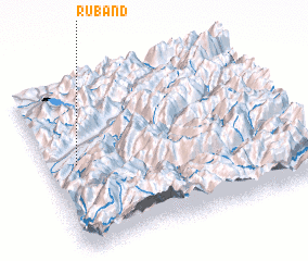 Places with similar names to Ruband, France ::
// Rebentão (BR)
// Rio Bonito (BR)
// Rio Bonito (BR)
// Rio Bonito (BR)
// Rio Bonito (BR)
// Rio Bonito (BR)
// Rio Bonito (BR)
// Rio Bonito (BR)
// Rio Bonito (BR)
// Rio Bonito (BR)
Disclaimer :: Information on this page comes without warranty of any kind |
||
|
Where is Ruband? Elevation and coordinates ::
Latitude (lat): 45°31'0"N Longitude (lon): 6°7'0"E
Elevation (approx.): 386m (map arrows pan, magnifying glasses zoom) |
||
|
Visiting Ruband? Hotel/Accommodation ::
Book a hotel in Ruband Travel Guide ::
Buy a travel guide for France rental cars ::
car rental offers GPS waypoint ::
download a GPX waypoint (PoI) of Ruband for your GPS receiver
|
||